| Route Section Map |
Route Section Name |
Status Details |
Recorded |
Physical |
1983 |
2004 |
|---|
 |
Stevenage 41 BOAT |
|
BOAT |
|
Ph 1 |
Existing |
 |
Stevenage 42 |
ROWIP suggestion |
FP |
|
Ph 1 |
Existing |
 |
Stevenage 98 BW |
Hard-surface alternative to Stevenage 42. The parts either side of Stevenage 42 are Phase 1 routes. |
BW |
|
Part Ph 1 |
Parts Existing |
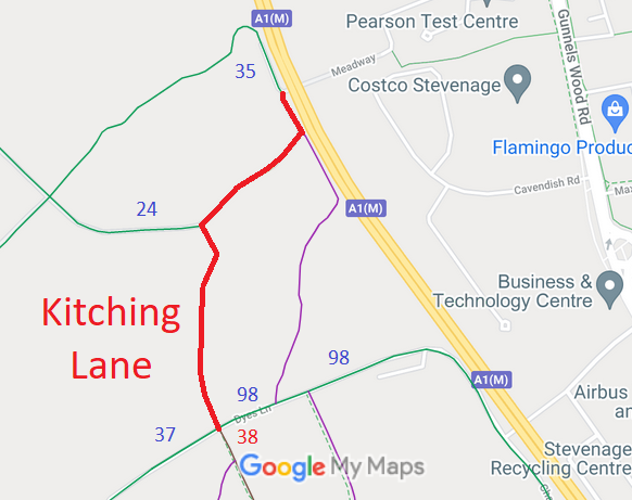 |
Kitchin Lane |
Recorded on List of Streets
1 Nov 2010: Application made to record Kitching Lane as a byway. HCC reference STV/33.
|
LOS |
|
Ph 1 |
Existing |
 |
Meadway |
Public Road
|
LOS |
|
Ph 1 |
Existing |
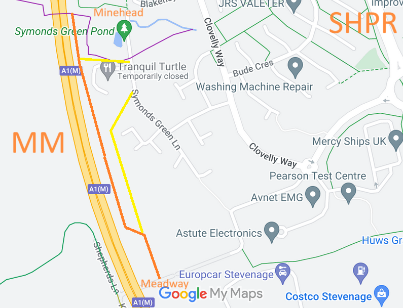 |
Meadway to Minehead Way |
SHPR (ROWIP suggestion)
|
|
|
Ph 2 |
Existing |
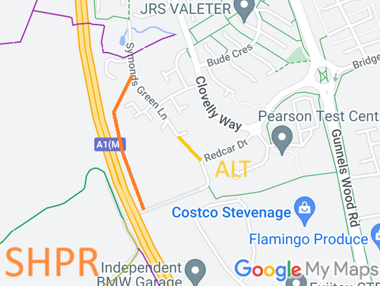 |
Meadway to SGL |
Off-road route to Symmonds Green Lane
|
? |
|
Ph 2 |
|
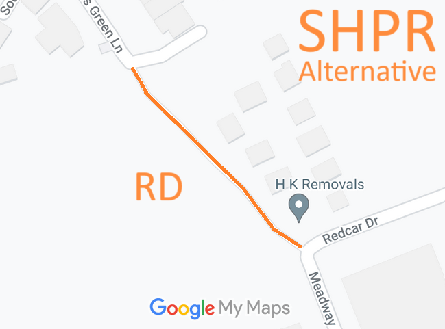 |
Meadway/Redcar Drive to Symmonds Green Lane
Wet weather route |
Old road, closed to motor vehicles. Highly suitable. But signposted as for cycling, so DMMO application for byway made 16 Dec 23, HCC reference STV/47.
|
LOS
Y Route |
|
Ph 1 |
Existing |
 |
Symmonds Green Lane |
Public Road
|
? |
|
Ph 1 |
Existing |
 |
Symmonds Green Road |
Public Road
|
? |
|
Ph 1 |
Existing |
 |
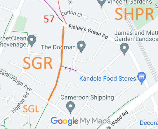
Stevenage 57 RB |
4 Apr 2006: Application to record route as byway instead of footpath. HCC reference STV/29.
3 Oct 2008: The Hertfordshire County Council (Stevenage 57) Modification Order 2008 (confirmed 5 Mar 2009) recorded this route as a restricted byway on the definitive map and statement |
RB |
|
Ph 1 |
Existing |
 |
Pegasus Crossing and Underpass |
This is the link route (highway verge) from Stevenge 57 RB, parallel to the A602, with a Pegasus Crossing at the Sainsbury's entrance and an underpass (Pony Lane) of the A602. The route then turns southwards to link to Stevenage 103 BW. |
N/R |
|
|
Existing |
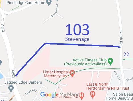 |
Stevenage 103 BW |
26 Jan 2001: The Corey's Mill Bridleway Public Path Creation Agreement between Hertfordshire County Council, the Commission for New Towns, East and North Hertfordshire National Health Service Trust, and Stevenage Sports Club Limited under s.25 Highways Act 1980 created this bridleway.
|
BW |
|
Ph 1 |
Existing |
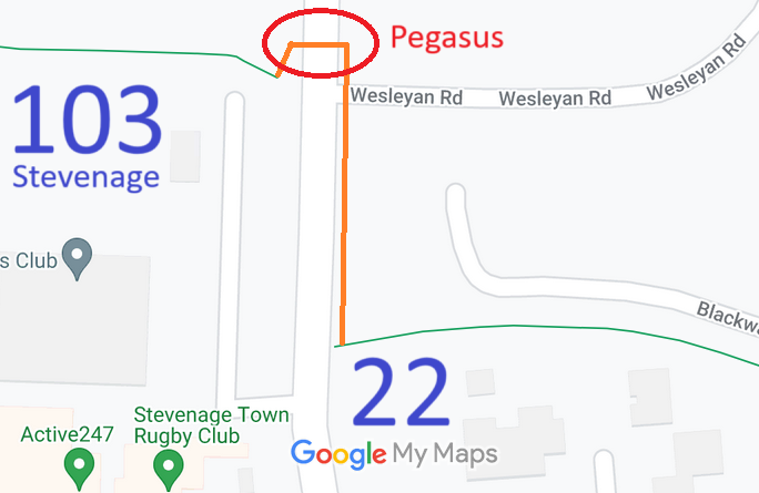 |
Pegasus Crossing and Verge |
This is the link route from Stevenage 103 BW, using a Pegasus Crossing to cross North Road, then turning south along the highway verge, to reach Stevenage 22 BW. |
N/R |
|
|
Existing |
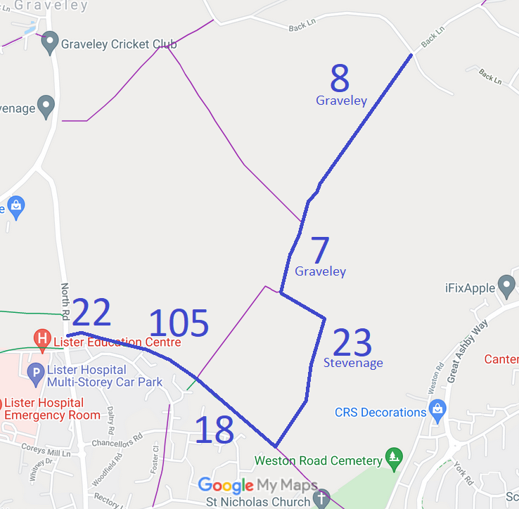 |
Stevenage 22 BW |
10 Mar 2006: Application to record Stevenage 22 FP as BW and add a BW from Stevenage 22 to Stevenage 17. HCC reference STV/22.
25 Jan 2019: The Hertfordshire County Council (Stevenage 17, 18, 22 and 23 and Graveley 7) Legal Event Modification Order 2019 recorded this bridleway. |
BW |
|
Ph 1 |
Existing |
|
Stevenage 105 BW |
4 Aug 2006: The Stevenage 105 Public Path Creation Agreement 2006 came into operation, adding a bridleway between Stevenage 22 and Stevenage 17.
25 Jan 2019: The Hertfordshire County Council (Stevenage 17, 18, 22 and 23 and Graveley 7) Legal Event Modification Order 2019 recorded this bridleway. |
BW |
|
Ph 1 |
Existing |
|
Stevenage 18 BW |
25 Jan 2019: The Hertfordshire County Council (Stevenage 17, 18, 22 and 23 and Graveley 7) Legal Event Modification Order 2019 recorded this bridleway.
In 1983, the Phase 1 route used Stevenage 17 instead. Subsequently diverted to this route. |
BW |
|
Div |
|
|
Stevenage 23 BW |
25 Jan 2019: The Hertfordshire County Council (Stevenage 17, 18, 22 and 23 and Graveley 7) Legal Event Modification Order 2019 recorded this bridleway.
In 1983, the Phase 1 route used Stevenage 17 instead. Subsequently diverted to this route. |
BW |
|
Div |
|
|
Graveley 7 BW |
25 Jan 2019: The Hertfordshire County Council (Stevenage 17, 18, 22 and 23 and Graveley 7) Legal Event Modification Order 2019 recorded this bridleway. |
BW |
|
Ph 1 |
East Herts |
|
Graveley 8 BW |
|
BW |
|
Ph 1 |
East Herts |
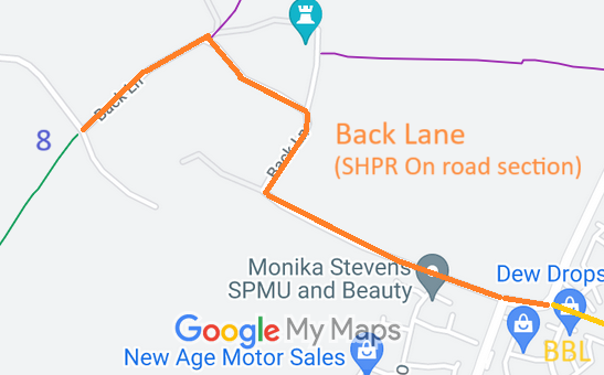 |
Back Lane |
Public Road |
N/R |
|
Road |
East Herts |
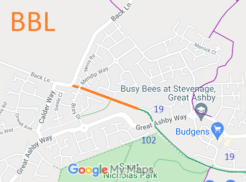 |
Bottany Bay Lane |
20 Jul 2000: The Borough of Stevenage (Bottany Bay Lane) (Prohibition of Driving) Order 2000 prohibits the use of this route by motor vehicles.
12 Oct 2015: Application to record as a byway. HCC reference STV/37 and NH/276. |
|
|
Road |
Existing |
 |
Great Ashby 19
Stevenage 102 BW |
23 Mar 1998: The Stopping up of Highways (County of Hertfordshire) (No.1) Order 1998 changed this old road into a public bridleway.
28 Jul 2000: The Hertfordshire County Council (Stevenage 102 and Graveley 19) Legal Event Modification Order 2000 added the bridleway to the definitive map and statement. |
BW |
|
Road |
Existing |
 |
Great Ashby 13A |
Route confirmed. ROWIP candidate. Owner: Stevenage Borough Council |
FP |
|
Ph 1 |
Existing |
 |
Unrecorded 13Z |
Route from Great Ashby 13A to Great Ashby 13.
ROWIP candidate Owner: Stevenage Borough Council |
FP |
To check |
Ph 1 |
Existing |
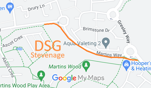 |
Unrecorded DSG route |
Route from Wedgwood Way to Gresley Way around side of Martins Wood.
ROWIP candidate Owner: DSG Retail Ltd |
--- |
To check |
Ph 1 |
Existing |
 |
Fairlands Way margin |
Roadside Margin |
|
|
|
|
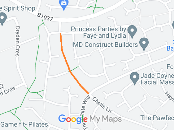 |
Knights Templar Green to Chells Lane |
Unrecorded route. ROWIP candidate Owner: Chells Lane Ltd |
? |
|
|
|
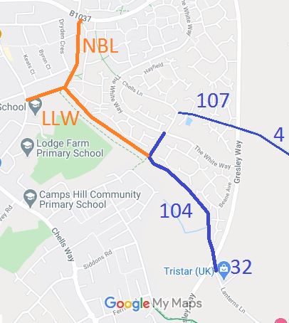 |
Narrow Box Lane |
21 Sep 2020: Application STV/44 to record Narrow Box Lane as byway. |
|
|
|
Existing |
|
Lanterns Lane West |
20 Sep 2020: Application STV/43 to record Lanterns Lane (West) as byway.
|
|
|
|
Existing |
 |
Stevenage 104 BW |
1 Sep 1985: Lanterns Lane (East) stopped up reserving bridleway rights by Stevenage Magistrates Court.
13 Dec 2002: The Hertfordshire County Council (Stevenage 104 and Aston 32) Legal Event Modification Order 2002 added Lanterns Lane (East) to the definitive map as a bridleway. |
BW |
|
|
Existing |
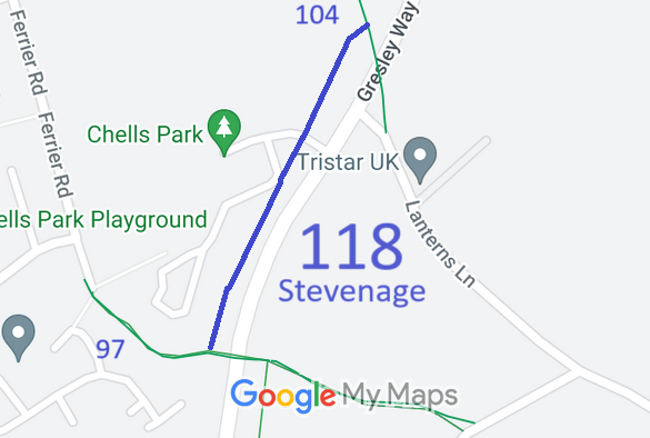 |
Stevenage 118 |
Path legally created (by public path creation order). Opened 12 Jul 24 by Mayor of Stevenage. Awaiting Legal Event Modification Order (LEMO) to add it to the definitive map. |
BW
Awaiting LEMO |
|
|
Existing |
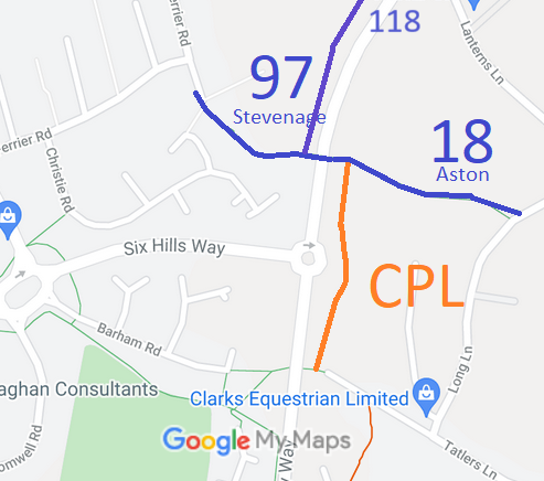 |
Sheafgreen Lane
Stevenage 97 BW |
|
BW |
|
|
Existing |
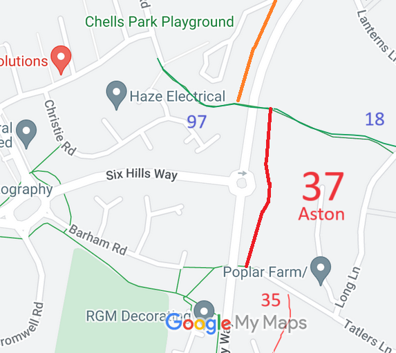 |
Charlie Piddle's Lane
Aston 37 RB |
1 Nov 2010: Application to record as restricted byway. HCC reference EH/381.
17 Feb 2022: The Hertfordshire County Council (Aston 37) Modification Order 2022, confirmed 17 Nov 2022, added this route to the definitive map and statement as a restricted byway. |
RB |
|
|
Existing |
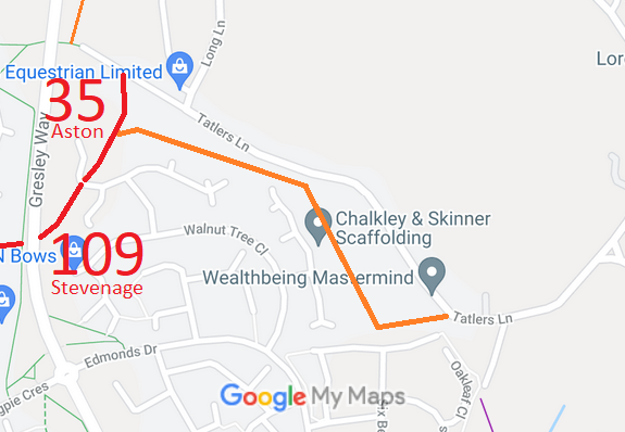 |
Aston 35 RB |
23 Sep 2011: The Hertfordshire County Council (Aston 34 & 35, Stevenage 109) Modification Order 2011, confirmed 22 Oct 2013, recorded Aston 35 as restricted byway. |
RB |
|
|
East Herts |
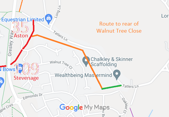 |
Path to rear of Walnut Tree Close (shown orange) |
Not recorded. Needs to go on ROWIP |
|
|
|
Existing |
|
Beehive Way to Tatlers Lane (shown green) |
8 Sep 2018: DMMO application for restricted byway status. HCC reference EH/469. Needs to go on ROWIP |
|
|
|
Proposed |
 |
Path to East of Ten Acres Crescent |
Path legally created (by public path creation order), 23 Jul 26. Awaiting Legal Event Modification Order (LEMO) to add it to the definitive map. |
BW awaiting LEMO |
|
|
Proposed |
| |
Path Name |
Table to be continued southwards |
|
|
|
|
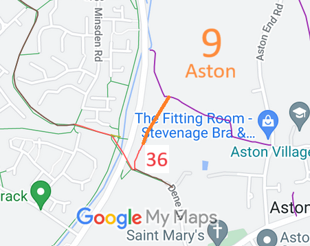 |
Aston 9 and (small part of) 8 |
27 Jul 2024: DMMO application for restricted byway status. HCC reference awaited. Needs to go on ROWIP |
|
|
|
|
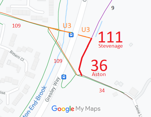 |
Stevenage 111, Aston 36 |
Table to be continued clockwise |
|
|
|
|
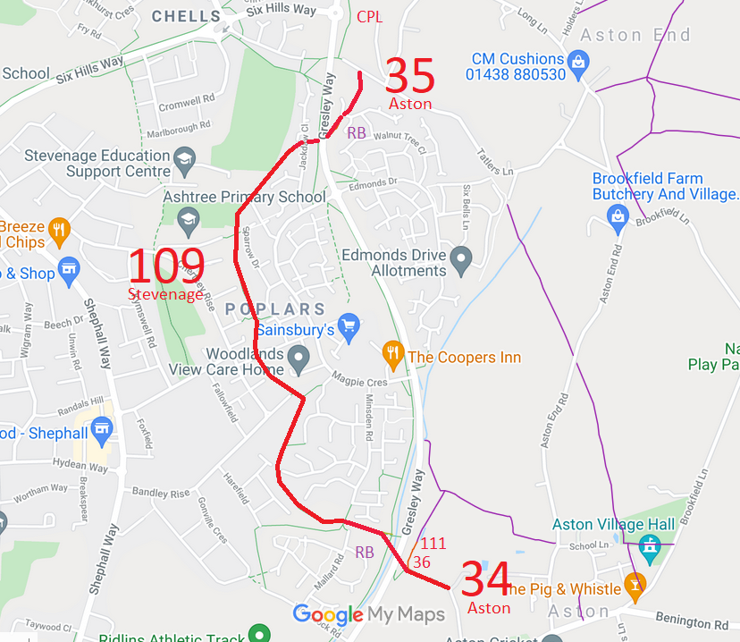 |
Aston 34, Stevenage 109 |
Over bridge to west side of Gresley Way |
|
|
|
|
| |
Path Name |
Table to be continued clockwise |
|
|
|
|
 |
Broadwater Crescent to Stevenage 78 |
|
|
|
|
|
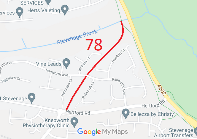 |
Stevenage 78 BOAT |
|
BOAT |
|
|
|
| |
Path Name |
Table to be continued clockwise |
|
|
|
|


