Paths Greenways Bridleways Tracks
 PG: OBJECTS: PROMOTION: STEVENAGE: Stevenage Horse and Pony Route - Diagonal Route  SHPDR 
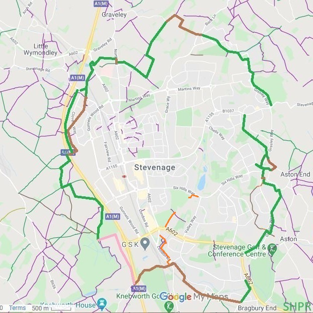
Stevenage Horse and Pony Route Outline In the 1970s, the Stevenage Development Corporation set out a Stevenage Horse and Pony Route that would be completed as Stevenage was developed as a New Town [1]. However, although the route was often constructed, it wasn't added to the definitive map. Consequently some parts were encroached upon by development.

Ensuring the whole route is recorded is a major piece of work. It is being led by the British Horse Society, and will help ensure that future developers can't remove the paths that were put in without full public rights of objection. The project also aims to find a new route where the original route is now built on.

The diagram shows the approximate route of the Stevenage Horse and Pony Route, as shown in Stevenage Borough Council's local plan (2004) [2]. At present the green routes are off the metaled road and in place. Brown routes are along roads. The pink route is a break in the route at present that is planned to be fixed when opportunities permit. Gaps are awaiting survey before we update the map.
Route Section Map Route Section Name Status Details Recorded Physical 1983 2004
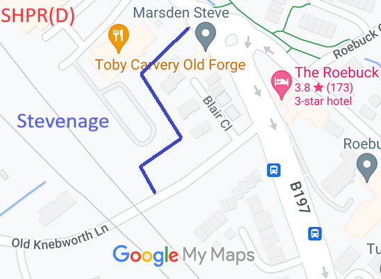
Stevenage Old Knebworth Lane to London Road     Ph 1 Existing
References
[1] Stevenage Horse and Pony Riding Route, 2nd edition, 1983, Stevenage Borough Council.
[2] Stevenage Local Plan Proposals Map, adopted 8 Dec 2004. This shows the full route (open and prospective).

© 2024 Patchetts Green Bridleways Trust. Route outline contains Ordnance Survey data © Crown copyright and database right / CC BY-SA
File reference: EH012 (SHPR)

Stats2