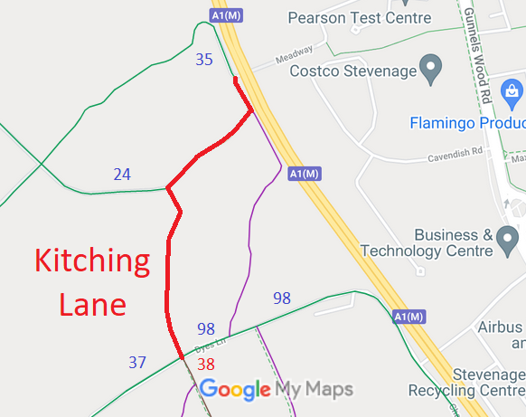
Annotated map reproduced courtesy of Googlemaps.
We need a volunteer to photograph this route for this year's Access and Riding Rights of Way Survey. It's easy - just take photographs (safely) when you use the path. Find out more!
| Paths Greenways Bridleways Tracks | ||
| PG: OBJECTS: PROMOTION: Stevenage Kitching Lane | ||
| Stevenage Horse and Pony Route: Anti-clockwise: Stevenage 98. Clockwise: Medway. | SHPR | |
Annotated map reproduced courtesy of Googlemaps. |
We need a volunteer to photograph this route for this year's Access and Riding Rights of Way Survey. It's easy - just take photographs (safely) when you use the path. Find out more! |
| Legal History 1983: The route is shown in Stevenage Borough Council leaflet as part of Phase 1 SHPR which is stated as being open for use. 8 Dec 2004: This route is described as part of the existing Stevenage Horse and Pony Route on the Stevenage Local Plan map. 1 Nov 2010: Application made to record Kitching Lane as a byway. HCC reference STV/33. 17 Oct 2013: HCC issues investigation report. 24 Feb 2014: HCC decides it had wrongly prioritised the case and decides to put it back in the queue. 30 Oct 2018: Secretary of State directed the council to determine the application by 30 Apr 2019. (FPS/M1900/14D/15)
|
Definitive Map sheet: 29 [This is an unsurfaced public road and so there is no definitive statement.] |
© 2024 Patchetts Green Bridleways Trust.
File reference: EC497.
