Legal History
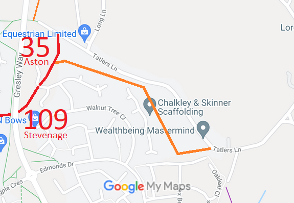
1840: Aston 35 was shown on the Aston tithe map as not subject to an apportionment.
1 Nov 1953: The route was not recorded on the original definitive map and statement.
31 Dec 1977: The route was not shown on the special review draft map and statement. DM sheet SR-30.
23 Sep 2011: The Hertfordshire County Council (Aston 34 & 35, Stevenage 109)
Modification Order 2011 would have added this route as part footpath part bridleway. Following objections, it was confirmed 22 Oct 2013 as part byway part restricted bwway.
26 Aug 2026: Access survey. No problems seen.
|
Definitive Statement (4 Dec 2015)
Path: [Aston] 35. Status: Restricted Byway.
Definitive Map sheet: 30
Dene Lane. Commences from Stevenage RB 109 at the parish boundary at TL 2673 2404
running generally NE then N for approx 100m to a junction with Tatlers Lane (public road)
at TL 2675 2413.
Width: Varies between 5m & 12m as shown shaded grey on the Order Plan forming part
of the Hertfordshire County Council (Aston 34 & 35, Stevenage 109) Modification Order 2011.
Limitations: None
Path: [Stevenage] 109. Status: BOAT/RB.
Definitive Map sheet: 30
Dene Lane. Commences as Restricted Byway from Aston BOAT 34 at the parish boundary at TL 2691 2282 continuing generally NW across the footbridge over Gresley Way for approx 115m to TL 2685 2292 then generally west for 110m to a junction with the access between Bittern Close and Minsden Road at TL 2674 2295. Continues as a BOAT running generally W then NW then NE for approx 450m to a junction with an access to Magpie Crescent at TL 2662 2327. Continuing generally NW then N then NE for approximately 780m to TL 2658 2393 adjacent to the rear of Nos. 87 & 89 Jackdaw Close. Continues as a Restricted Byway for approx 200m running across Jackdaw Close and between Nos. 32 & 34, crossing Gresley Way and Watercress Close to join Aston RB 35 at the parish boundary at TL 2673 2404.
Width: Varies between 2.8m & 11m as shown shaded grey on the Order Plan forming part of the Hertfordshire County Council (Aston 34 & 35, Stevenage 109) Modification Order 2011.
Limitations: None
|