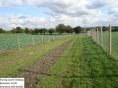
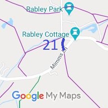
 Shenley 39 is part of the old Packhorse Lane. It was added to the definitive map by a modification order which we applied for in 1998 and which was made in 2009 and confirmed in 2013. The tenant applied for a diversion out of his farmyard, and opened the new route on a permissive basis while the legal work for a diversion was undertaken.
Between the consultation for the diversion order (which we supported) and the making of the order, the Ordnance Survey updated its base map. As a result, a small gap was introduced between the new line of the Bendy bridleway and the verge of Mimms Lane, which would make for a longer route for riders wishing to head northwards along Shenley 33 byway. We objected (and the tenant and County Council agreed with us), and the Inspector appointed by the Secretary of State agreed to modify the order to make sure the bridleway and the wide verge of Mimms Lane touched. All being well, we expect the order to be confirmed before Easter 2023.
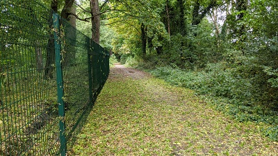 We applied for this route to be recorded in 1995 following the route’s identification by the Patchetts Green Riding Club during the survey of ridden rights of way in 1991. The application languished at the bottom of the County Council backlog until we asked the Secretary of State to direct the council to determine the application. They turned down the application (although admitted the public rights of access) so we appealed, and the Secretary of State directed the council to make the order recording the path as a byway. There were objections and the County Council doesn’t wish to defend its order, so we will be leading the arguments for the confirmation of the order as it is progressed by the Planning Inspectorate during 2023.
 We applied for this path to be recorded in 1995, and because the County Council were taking so long, in 2018 we asked the Secretary of State to direct them to make a decision, which he did. The Council investigated in 2022 and decided that there was insufficient user evidence of the route to enable them to record it as bridleway.
However, the land the route crosses was identified as being a metropolitan common, that is a common which was covered by the Metropolitan Police area in 1866. This automatically gives riders the right to ride the route even though it isn’t recorded as a bridleway.
The Trust is currently investigating appropriate signage to show this at the ends of the path, so that riders are not put off by the footpath signs.
 We applied for this path to be recorded as long ago as 2003. After fifteen years of the application languishing in Hertfordshire County Council’s backlog, we asked the Secretary of State to direct the Council to expedite determination. The Council then investigated, and in 2022 made an order to record the whole route. The route joins South Mimms 71 bridleway to Potters Bar 75 bridleway and then to the open public road part of Wash Lane. It forms part of the South Mimms Parish Ride which is under development.
There is now one outstanding objection which relates to a gap between South Mimms 71 bridleway and Dancers Lane. The County Council had assured user groups that this was part of the public road and so did not need to be covered by an order, and it promised to update the road records. As soon as that is done, the order can be confirmed. The County Councilhas promised that this will be done by the end of February 2023. This should allow the order to be confirmed before the definitive map of rights of way is next consolidated and published.
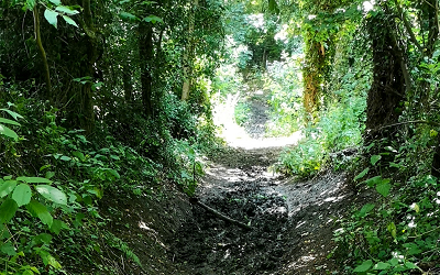 As part of the British Horse Society’s work to record the Stevenage Horse and Pony Route as an aid to defending it from development, it was supotted that Charlie Piddle’s Lane was not recorded on the definitive map. The historical evidence showed a continuous route, so an application was made in 2010 to record the gap. The County Council agreed with the application in 2019, and an order was published in 2022 and confirmed unopposed. This is a good example of ‘perfectly obvious paths’ that would be extinguished by the Countryside and Rights of Way Act 2000 if an application had not been made in time.
This route forms part of the Stevenage Horse and Pony Route.
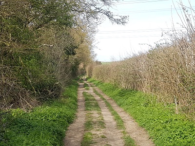 As part of the British Horse Society’s work to record paths before
Path Extinguishment Day,
it was spotted that this route was unrecorded on the definitive map of rights of way.
The historical evidence showed a continuous route with Hitchin 28 Byway, so an application was made in 2013 to record the route.
The County Council agreed with the application and an order was made in 2021
and confirmed unopposed.
This is yet another good example of ‘perfectly obvious paths’ that would be made unrecordable by the Countryside and Rights of Way Act 2000 if an application had not been made in time.
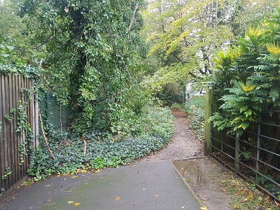 We were pleased to assist the Three Rivers District Council in implementing some bridleway creations in the district. The first of these was Batchworth 30. This is a path (formerly known as Rickmansworth 30) leading from High Street Rickmansworth towards Croxley Green 11 bridleway.
In 2016, a diversion of the footpath out of a school playing field was accompanied by an upgrade to bridleway status. This was largely through the hard work and diligence of Chris Beney of the Bushey and District Footpath Association and Open Spaces Society.
Now, Three Rivers District Council are keen to upgrade the part of the path that is still registered as a footpath. The Trust’s Secretary helped the District Council prepare the order to upgrade the path, perform the pre-order consultations and get District Council approval for the upgrade.
A creation order was made on 19 December 2022 and we will report on its progress next year. Even after this one, there will still be two more sections to record before the legal record shows a continuous route, but it is physically open and available for use already

The Hertfordshire County Council (Aston 37) Modification Order 2022, made 17 Feb 2022 and confirmed 17 Nov 2022, added this route to the definitive map and statement as a restricted byway.
The Hertfordshire County Council (A120 Little Hadham Bypass) Legal Event Modification Order 2022, made 25 Aug 2022, altered the definitive map and statement in respect of changes made by the Hertfordshire County Council (A120 (Little Hadham) Bypass Classified Road) (Side Roads) Order 2017. This affected paths
Bishop's Stortford 9 BW,
Bishop's Stortford 10 BW,
Little Hadham 35 BW,
Little Hadham 36 BW,
and various footpaths.
The Hertfordshire County Council (Aldenham 12, Aldenham 84) Modification Order 2018, made 14 Dec 2018, proposes to add a bridleway along the physical roadway though Wall Hall.
The Hertfordshire County Council (Bushey 76) Modification Order 2019, made 27 Nov 2019, proposes to add Finch Lane to the definitive map and statement as a byway open to all traffic.
The Hertfordshire County Council (Little Berkhamsted 18) Modification Order 2021, made 23 Sep 2021, proposes to alter the alignment of this bridleway at the southern end on the definitive map and add detail to the definitive statement.
The Hertfordshire County Council (Hitchin 42) Modification Order 2022, made 10 Mar 2022, proposes to record 25m of Hitchin 42 FP as restricted byway.
The Hertfordshire County Council (South Mimms 81) Modification Order 2022, made 21 Apr 2022, proposes to add Wash Lane to the definitive map and statement as a byway.
The Central Bedfordshire Council (Definitive Map and Statement for Central Bedfordshire) (Hyde: Byway Open to All Traffic No 15) Modification Order 2022, made 1 Apr 2022, proposes to record the Bedfordshire moiety of this route to the definitive map for Central Bedfordshire as a byway open to all traffic. The objection period closed 27 Apr 2022 and several objections were received by the council.

© 2025 Patchetts Green Bridleways Trust.
