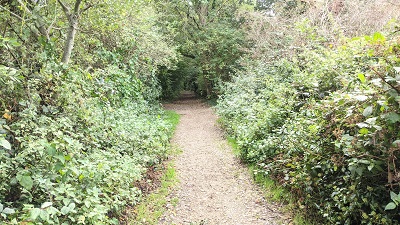
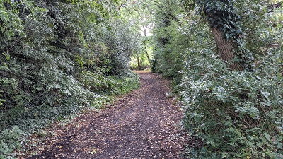
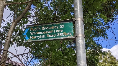
Image of Bushey 52 bridleway (Whomsoever Lane) taken in 2021 by Michael Rackham showing track between hedgerows
Patchetts Green Bridleways Trust
Bushey 52 Whomsoever Lane


 PG: OBJECTS: PROMOTION: Bushey 52 Whomsoever Lane
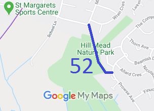
Map showing Bushey 72 bridleway
Annotated map reproduced courtesy of Googlemaps.
‘Whomsoever Lane’ is the bridleway from Merry Hill Road generally south-south-east to Prowse Avenue, in Bushey parish. This path is actually a very old route which was in use at the time it was recorded. The order to record the path was unopposed, making this a quick acquisition compared to others! The Merry Hill Greenway (part of the H25 London Orbital Bridleroute) has a junction with Merry Hill Road to the west of this path.

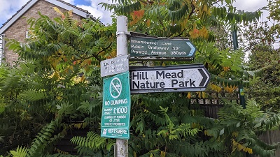
At the time of the BHS 2021 Access Survey (27 Sep 21), the path was correctly signposted at each end and was not obstructed.

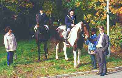
Official opening of Whomsoever Lane

Official Opening of Newly Recorded Bridleway (1992)

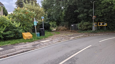
Photograph of Whomsoever Lane, Bushey 52
1. Start of path from Merry Hill Road
Photo: Michael Rackham, 27 Sep 2021
Photograph of Whomsoever Lane, Bushey 52
2. Path signage at Merry Hill Road
Photo: Michael Rackham, 27 Sep 2021
Photograph of Whomsoever Lane, Bushey 52
3. Heading southwards along path
Photo: Michael Rackham, 27 Sep 2021
Photograph of Whomsoever Lane, Bushey 52
4. View southeastwards along path
Photo: Michael Rackham, 27 Sep 2021
Photograph of Whomsoever Lane, Bushey 52
5. Path signage at Prowse Avenue
Photo: Michael Rackham, 27 Sep 2021
BADFA A special acknowledgement is due to the Bushey and District Footpaths Association for their work towards the recording of this bridleway.

Legal History
1840: Bushey 52 was shown on the Bushey tithe map as not subject to an apportionment.
20 Jun 1953: The route was not recorded on the original definitive map and statement. DM sheet DM3-43 (TQ19SW) (also Herts 44 NE).
2 Jun 1992: The Hertsmere Borough Council (Bridleway No 52 Bushey) Modification Order 1992 (confirmed 12 Aug 1992) added this path known as ‘Whomsoever Lane’ to the definitive map as a bridleway.
Application Process
Path Application Certificate Direction Inv Report Order Confirmed
EC000     N/A   2 Jun 1992 12 Aug 1992
Definitive Statement (10 Dec 2005)
Path: [Bushey] 52. (Whomsoever Lane)  Status: Bridleway  Definitive Map sheet: 90
Commences at junction with Merry Hill Road, Bushey (TQ 14040 94265) and continues in a SSE direction for a distance of approx. 310m (to TQ 14140 93985) and thence in an E direction for a distance of approx. 44m to the junction with Prowse Avenue (TQ 14180 93982) an overall distance of approx. 354m.
Width: varying between 8.5m at TQ 14045 94253 and 15m at TQ 14095 94060 and TQ 14120 94060 inclusive of boundary hedges and trees and giving a useful width at 19 May 1992 of between 7.5m and 10m
Maintainability
This route is maintainable at the public expense because it was a highway before 1835.

© 2025-2026 Patchetts Green Bridleways Trust. File reference: EC000.

Stats2