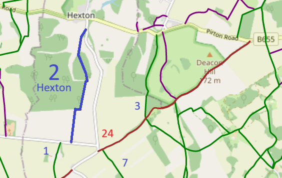
Map data from © OpenStreetMap and Hertfordshire County Council. |
This route runs from Lilley Road generally southwards to Streatley Road, near Hexton 1 bridleway.
At the time of the BHS 2022 Access Survey (13 Jul 22), the route was gated, the spaces to the side were too narrow for horses and there were signposts at each end indicating footpath. The gaps will need to be widened and the signs replaced when the modification order is confirmed.
Now that the order to record the route as a bridleway is confirmed, we look forward to the gates being removed or bypassed and the signs being updated. On 27 Aug 23 the ends of the path were checked to see if the path had been made accessible, but blockages and incorrect signage were found. (Reported to Council, 28 Aug 23.) On 1 Dec 24, it was spotted that the footpath signs were changed to bridleway signs.
|
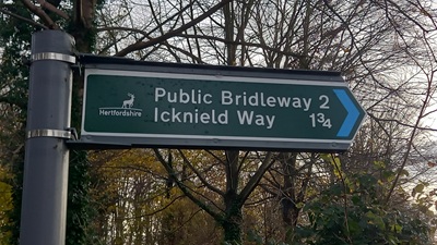
Sign at northern end of path
Photo: Phil Wadey, 1 Dec 2024
|
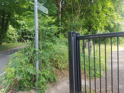
Start of path, northern end
Photo: Phil Wadey, 13 Jul 2022
|
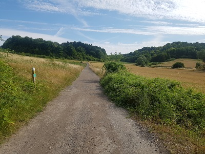
Heading south on defined track
Photo: Phil Wadey, 13 Jul 2022
|
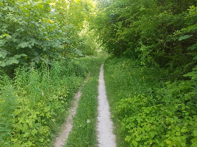
Continuing south, through wooded area
Photo: Phil Wadey, 13 Jul 2022
|
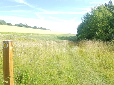
Continuing south: field headland
Photo: Phil Wadey, 13 Jul 2022
|
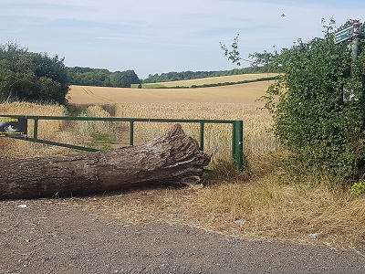
Looking north from road
Photo: Phil Wadey, 13 Jul 2022
|
 As part of the British Horse Society's work to record paths before
Path Extinguishment Day,
it was spotted that Hexton 2 should be recorded as a bridleway rather than as a footpath, so an application was made in 2018 to record the change of status.
The County Council agreed with the application and an order was made in 2021 to record Hexton 2 as a bridleway, and to add another bridleway close by as Hexton 13. In 2022, there was a consultation on the extinguishment of Hexton 13. The BHS proposed that in return for the 2,500 square metres of path extinguished, a new path 170m long be created to join Hexton 1 and Hexton 2 so that walkers, riders and cyclists need not use the busy road to link the paths.
After this, the original order was confirmed unopposed and the extinguishment did not take place.
This is a good example of 'perfectly obvious paths' that would be extinguished by the Countryside and Rights of Way Act 2000 if an application had not been made in time. |
Legal History
1837: Most of Hexton 2 was shown on the Hexton tithe map as part of parcel 201, a bridleway owned by the surveyor of highways and not subject to an apportionment.
1938: The route is shown as Hexton BW 5 (blue dots) on the Hertfordshire County Council
ROW survey.
Maps Hitchin Rural West 3 (Herts 6 SW) and 6 (Herts 9 NW).
1 Nov 1953: The route was recorded as a footpath on the original definitive map and statement.
DM sheets DM4-13 (Herts 6 SW) and DM4-27 (Herts 9 NW).
31 Dec 1977: The route was recorded as a bridleway on the special review draft map and statement.
DM sheets SR-10 (TL13SW) and SR-19 (TL12NW).
17 Sep 2018: Application to record route as a bridleway. HCC reference NH/311.
19 Dec 2019: HCC advise order for bridleway will be made.
10 Jun 2021: The Hertfordshire County Council (Hexton 2 and 13) Modification Order 2021 (confirmed 27 Apr 23) added this route to the definitive map and statement.
22 Feb 2022: HCC consulted on landowner request to delete Hexton 13 BW. The BHS proposed that a link BW be put in between Hexton 1 and Hexton 2 BW and then it would be able to agree the package. This was not taken up by the landowner.
27 Apr 2023: Order confirmed by HCC.
7 Jun 2023: Confirmed order advertised by HCC.
|
| Application Process |
| Path |
Application |
Certificate |
Direction |
Inv Report |
Order |
Confirmed |
| EC571 |
17 Sep 2018 NH/311 |
3 Oct 2018 |
Not Required |
16 Aug 2019 |
10 Jun 2022 |
27 Apr 2023 |
28 Aug 2023: Council footpath sign at southern end of path reported to HCC as should say bridleway.
Reference: 401003632836.
28 Aug 2023: Lack of gap for horses at southern end of path reported to HCC.
Reference: 401003632839.
28 Aug 2023: Council footpath sign at northern end of path reported to HCC as should say bridleway.
Reference: 401003632842.
28 Aug 2023: Lack of gap for horses at northern end of path reported to HCC.
Reference: 401003632843.
31 Dec 2023: Path checked and no action taken to open up the path or signpost it correctly.
2 Jan 2024: Reported lack of progress on previous fault reports to Hertfordshire County Council. Reference: 401003867387.
1 Dec 2024: Bridleway signs now in place, but there are now concrete blocks at the southern end of the path and the gate is still in place.
7 Dec 2024: Reported concrete blocks to Hertfordshire County Council. Reference: 401004473607.
7 Dec 2024: Reported continued presence of gate at northern end to Hertfordshire County Council. Reference: 401004473613.
7 Dec 2024: Hertfordshire County Council notified that a s.130A notice is being contemplated.
|
|
Definitive Statement (8 Jun 2021)
Path: [Hexton] 2. Status: Bridleway.
Definitive Map sheets: 10, 19
Commences from Lilley Road (public road) at TL 1063 3015, the N corner of
Fanny's Spinney, then SW following the track on W side of Fanny's Spinney for
approx. 140m to TL 1056 3003. Continues SSW following the track between fields
for approx. 260m to NW corner of Mortgrove Plantation at TL 1052 2977. Continues
SSE, on SW side of Mortgrove Plantation for approx. 465m, to join Hexton BR 13
at TL 1066 2933. Continues W for approx. 25m to W field edge at TL 1064 2933
then SSW, along E side of Burwell Plantation, for approx. 440m tojunction with
Hexton BR 13 at field boundary at TL 1056 2890. Continues W on S side of N field
boundary for approx. 70m to E side of the field boundary at TL 1049 2889.
Continues SSW on E side of the W field boundary for approx. 150m to a junction
with Hexton BR 13 at TL 1047 2874 and then SSW following E side of the W field
boundary for approx. 390m to join Streatley Road (public road) at TL 1043 2836.
Hexton - Lilley Road at N corner of Fanny's Spinney thence SW and S
along W edge of same to NW corner of Mortgrove Plantation thence S along W edge of
same and E of Burwell Plantation thence W and S to join county road NE of Mortgrove.
Width: Varies between 6 metres and 16 metres between TL 1063 3015 and TL 1056 3003, as shown in the Hertfordshire County Council (Hexton 2 and 13) modification Order 2021, narrowing to
4 metres between TL 1056 3003 and TL 1064 2933, widening to
5 metres between TL 1064 2933 and TL 1056 2890, narrowing to
4 metres between TL 1056 2890 and TL 1043 2836.
Limitations: None
Former Definitive Statement (4 Dec 2015)
Path: [Hexton] 2. Recorded Status: Footpath.
Definitive Map sheets: 10, 19
Commences from Hexton - Lilley Road at N corner of Fanny's Spinney thence SW and S
along W edge of same to NW corner of Mortgrove Plantation thence S along W edge of
same and E of Burwell Plantation thence W and S to join county road NE of Mortgrove.
|
Maintainability
This route is maintainable at the public expense because it was a footpath or bridleway existing before 30 Apr 1959.
|
|
