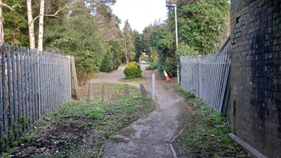
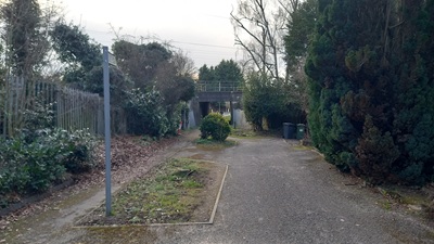
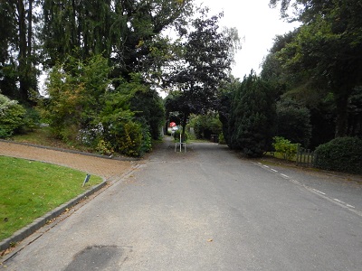
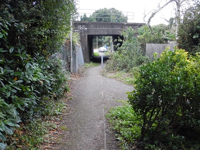
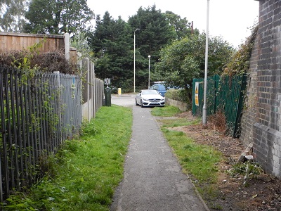
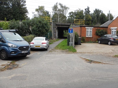
Image of Aldenham 68 bridleway taken in 2025 showing railway underbridge
 PG: OBJECTS: PROMOTION: Aldenham 68 The Avenue
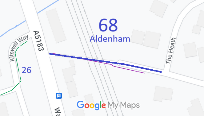
Map showing recorded Aldenham paths
Annotated map reproduced courtesy of Googlemaps.
This bridleway runs from Watling Street, almost opposite Aldenham 26, to The Avenue. Take care when crossing Watling Street.

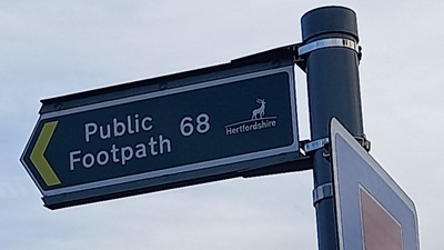
At the time of the 2025 Access Survey (6 Mar 2025), no gates were across the path. A bollard prevents use by wide motor vehicles. There were misleading 'Public Footpath' signs at either end.

Photograph of Aldenham 68 The Avenue showing a public footpath sign
Misleading FP sign at western end
Photo: Phil Wadey, 6 Mar 2025
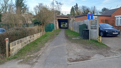
Photograph of Aldenham 68 The Avenue
Start of path from Watling Street
Photo: Phil Wadey, 6 Mar 2025
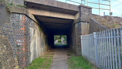
Photograph of Aldenham 68 The Avenue
Railway Underbridge
Photo: Phil Wadey, 6 Mar 2025
Photograph of Aldenham 68 The Avenue
Emerging eastwards from Tunnel
Photo: Phil Wadey, 6 Mar 2025
Photograph of Aldenham 68 The Avenue
View from The Avenue
Photo: Phil Wadey, 6 Mar 2025
BHS PGBTThe need to record this path was identified during the British Horse Society's Year of Access and Riding Rights of Way (ARROW) in 1991 by members of the Patchetts Green Riding Club. This route was shown on the 1991 Definitive Map as a footpath. An application for it to be shown as a bridleway was made in 1995. It passes under the railway. At the time, Railtrack said, "[This path] was originally referenced as a bridle road at the time the railway was constructed, and therefore not withstanding the present referencing of the right of way, there is nothing for Railtrack to dedicate." That is, the landowners admit that it is bridleway.

However, because no one was obstructing it, Hertfordshire County Council did not regard correcting the definitive map of rights of way as a priority. In September 2017, we asked the Secretary of State to direct the Council to determine the application. As a result, they completed the investigation, and made an order to record it at bridleway status. There were no objections to the order, and so Hertfordshire County Council will confirm it in due course.

Legal History
2 Feb 1953: The route was not recorded on the original definitive map and statement. DM sheet DM3-31 (TL10SE).
31 Dec 1977: The route was shown as a footpath on the special review draft map and statement. DM sheet SR-77 (TL10SE).
7 Aug 1995: Application made to have this path recorded as a bridleway. HCC reference HTM/68.
2 Oct 2016: Notice given to Council of intention to ask the Secretary of State to intervene.
3 Sep 2017: Complaint made to Secretary of State. FPS/M1900/14D/4.
7 Nov 2017: Secretary of State directed Hertfordshire County Council to make a decision on the application by 31 May 2018.
20 Mar 2018: Council circulates its Investigation Report.
21 May 2018: Council circulates its decision (of 2 May 18) to make an order for bridleway status.
13 Jul 2018: The Hertfordshire County Council (Aldenham 68) Modification Order 2018 was made, with a close of objection period on 17 Sep 18. No objections so it is to be confirmed.
9 Oct 2021: Path survey.
25 Oct 2021: Missing signage reported to Hertfordshire County Council. Reference 401002328302.
18 Aug 2022: Missing signage reported to Hertfordshire County Council. Reference 401002885967.
19 Apr 2023: New 'footpath' sign spotted at Watling Street end. HCC requested to correct to 'bridleway'.
6 Mar 2025: Path survey.
8 Mar 2025: Misleading 'footpath' signs reported to Hertfordshire County Council. Reference 401004573615 and 401004573616.
Application Process
Path Application Certificate Direction Inv Report Order Confirmed
EC126 7 Aug 1995 HTM/68 2 Oct 1995 7 Nov 2017 20 Mar 2018 13 Jul 2018 Awaited
Definitive Statement (21 May 18, from the Order)
Path: 68.  Status: Bridleway  Definitive Map sheet: 77
Commences from junction of The Avenue (privately maintainable public road) and The Heath (public road) at TQ 1612 0068 then NW along alley and under railway line to join Watling Street (public road) at TQ 1605 0070.
Width: Varies between 3.4 and 6.4 metres from TQ 1612 0068 to TQ 1605 0070, as shown in the Hertfordshire County Council (Aldenham 68) Modification Order 2018.
Limitations: None.
[This definitive statement only operates when the Council has actually confirmed the order.]
Maintainability
This route is maintainable at the public expense because it was a footpath or bridleway existing before 30 Apr 1959.
Photograph of Aldenham 68 The Avenue
Approaching the path from The Avenue
Photo: Michael Rackham, 9 Oct 2021
Photograph of Aldenham 68 The Avenue
From The Avenue
Photo: Michael Rackham, 9 Oct 2021
Photograph of Aldenham 68 The Avenue
Approaching Watling Street
Photo: Michael Rackham, 9 Oct 2021
Photograph of Aldenham 68 The Avenue
View from Watling Street
Photo: Michael Rackham, 9 Oct 2021
At the time of the survey (9 Oct 2021) there were no public path signs in place.

© 2025 Patchetts Green Bridleways Trust. File reference: EC126.

Stats2