
- Wheathampstead 1 and Ayot St Lawrence 2 BW, from Ayot St Lawrence to Codicote Road
- Wheathampstead 2 and Harpenden 1 BOAT
- Wheathampstead 3 and Hatfield 56 BOAT, from Colemans Green to Marford Road
- Wheathampstead 4 BOAT, from River Lee under bypass to Codicote Road
- Wheathampstead 5, Kimpton 62 RB and Hyde 14 FP, Gypsy Lane
- Wheathampstead 6 BOAT, from Lower Luton Road to Great Cutts Farm
- Wheathampstead 8 and Kimpton 50 RB
- Wheathampstead 9 and Sandridge 8 BW, from Ayres End Lane to High Street, Sandridge
- Wheathampstead 10 BW from Marshalls Heath to Rose Lane
- Wheathampstead 11 and Ayot St Peter 16 BW
- Wheathampstead 12 BW, from High Street to Byway 4 (part of Ayot Greenway)
- Wheathampstead 17 BW, from Codicote Road to BW 12
- Wheathampstead 18 BW, from Byway 4 to road at Waterend Farm
- Wheathampstead 19, Kimpton 41 and 56 BW
- Wheathampstead 31 and Kimpton 52 BW
- Wheathampstead 43 BW from Marshalls Heath Lane to BW 58
- Wheathampstead 54 BW, from Mackerye End Lane to Castle Rise
- Wheathampstead 58 BW, from BW 10 to BW 102
- Wheathampstead 95 BW, from BW 43 to BW 10
- Wheathampstead 97 BW, former railway line
- Wheathampstead 100 BW, from Lower Luton Road to Cherry Tree Lane
- Wheathampstead 101 BW, from Kimpton Road to Lamer Lane
- Wheathampstead 102 BW, from Plough Lane to BW 58
- Wheathampstead 103 BW, from BW 102 to The Slype
- Wheathampstead 105 RB, from Mackerye End to Marshalls Heath Lane
- Wheathampstead 106 RB Rose Lane, from Lower Luton Road to BW 10
- Wheathampstead 53, from Cromer Hyde Lane to Wheathampstead 3 Byway
- Wheathampstead P1 permissive bridleway off Waterend Lane
- Wheathampstead - Ayot Greenway
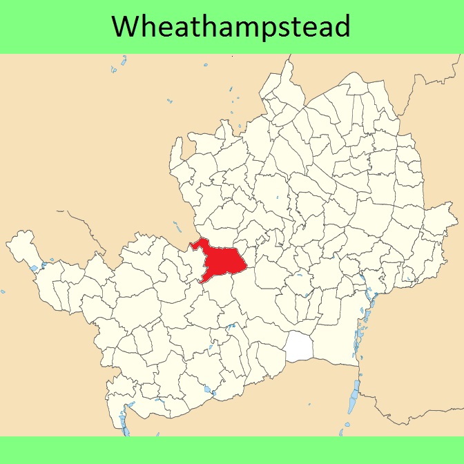




 Local Government: Formerly within St Albans Rural District. From 1974, part of St Albans City and District.
Tithe (1841) DSA4/116/2.
 The Wheathampstead Parish Council is preparing Neighbourhood Development Plan, which when made will count as part of the Local Development Plan when planning applications are considered.

