
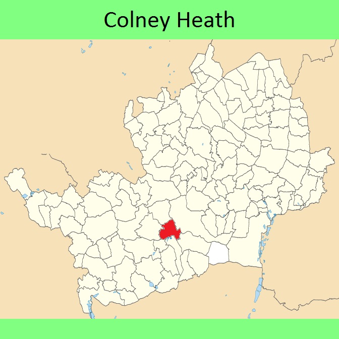
- Colney Heath 1 BW, from Sandrige 48 BW to Oaklands Lane
- Colney Heath 2 BW, from Smallford Lane to public road N of church
- Colney Heath 3 BW, from Sandridge 51 BW along Oaklands Drive then to the St Albans to Hatfield Road
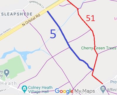
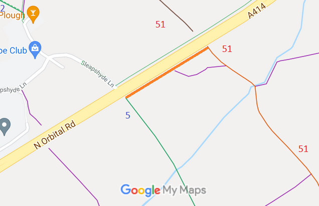
- Colney Heath 5 BW, from North Orbital Road opposite Sleapshyde Farm to junction of paths 24 and 51, N of Roundhouse Farm
- Colney Heath A414 Verge route
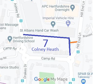
- Colney Heath 7 BW, from Hill End Lane and Camp Road to Ashley Road
- Colney Heath 27 permissive bridleway from Highfield Lane to Barley Mow Lane
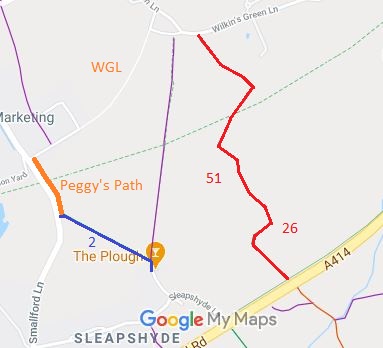
- Colney Heath 51 byway, from public road at Wilkins Green to North Orbital Road then to junction with BW 5 then to Roestock Lane.
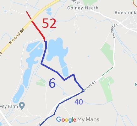
- Colney Heath 52 byway, from A414 North Orbital Road to Ridge 6 BW (and Tyttenhanger paths)
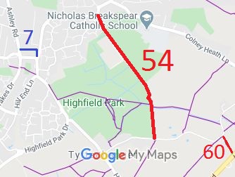
- Colney Heath 54 byway, Hixberry Lane, from public road to Hill End Lane
- Colney Heath 55 route from Church Lane to Ridge 2 BW
- Colney Heath 57 permissive bridleway from Nightingale Lane to Highfield Lane
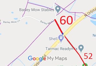
- Colney Heath 60 byway/BW Woodrake Lane from North Orbital Road to Barley Mow Lane
- Colney Heath 61 BW, from BW 3 to along Oaklands Drive to join the Hatfield Road.
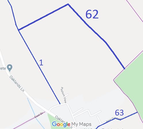
- Colney Heath 62 BW, from Colney Heath 15 to Colney Heath 1.
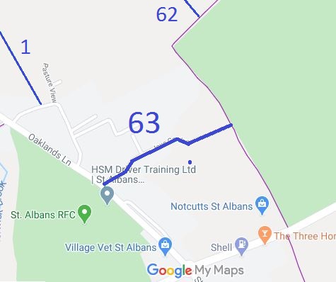
- Colney Heath 63 BW, from Oaklands Lane to Colney Heath 15.
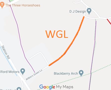
- Colney Heath Wilkins Green Lane
- Colney Heath Nightingale Lane
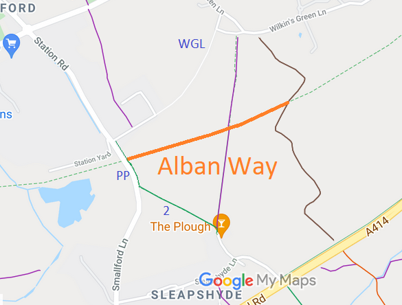
- Colney Heath Peggy's Path (BW 2 across Alban Way to Wilkins Green Lane)
- Colney Heath Alban Way from Peggy's Path to Byway 51 Colney Heath
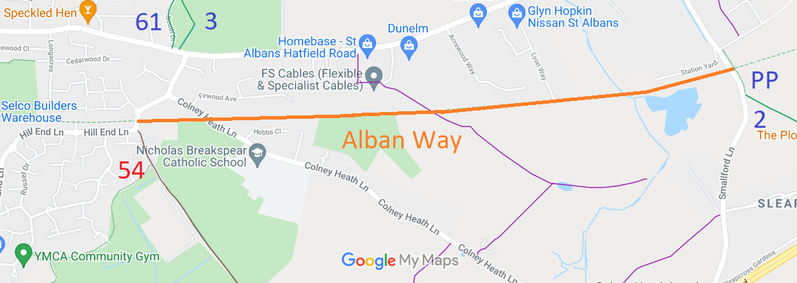
- Colney Heath Alban Way from to Byway 53 Colney Heath to Peggy's Path
- Colney Heath Butterwick Lane
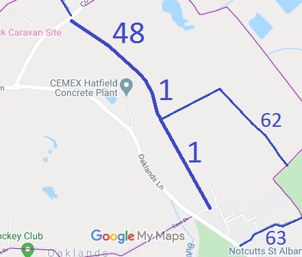
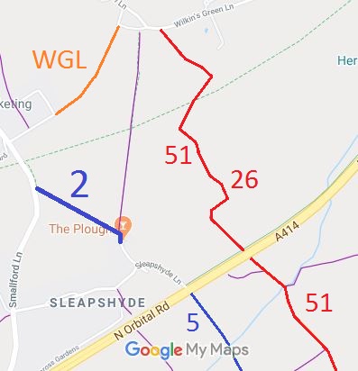
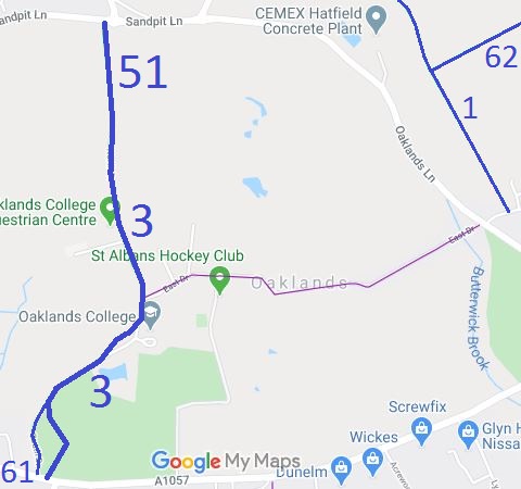
Annotated maps reproduced courtesy of Googlemaps.


 Local Government: Formerly within St Albans Rural District.
From 1974, part of the City and District of St Albans.
Tithe (St Albans St Peter) (c1840) DSA4/88/2.

