
 The last part of our Aldenham Major Project is the route through Wall Hall itself, on the metalled roadway. In 2012, we applied for this route using user evidence from 1970 onwards. We are pleased that the County Council agreed our application and made an order in 2018 to record the route as a bridleway. There was just one objection, and so the order has to be referred to the Secretary of State for determination.
In the summer, we started to collect witness statements for submission to the public inquiry into the rights through Wall Hall. Because of personnel changes at Hertfordshire County Council, it became apparent that we wouldn’t have the inquiry this year, so witness statement work slowed. We will pick this up again in the New Year.
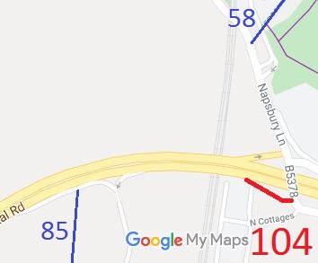 This route used to be a slip road onto the North Orbital Road westbound carriageway, but was stopped to motor vehicles in 1990 and turfed over. The motor vehicular rights were preserved from extinguishment by the Natural Environment and Rural Communities Act 2006 so the correct status is byway open to all traffic, but the right of use by motor vehicles remains suspended by a 1990 prohibition of driving order.
This route is strategically important, as it leads towards St Stephen 85 bridleway and to the land that could become the Strategic Rail Freight Interchange, which will come with new rights of way as part of the planning permission. The route was applied for in 1998.
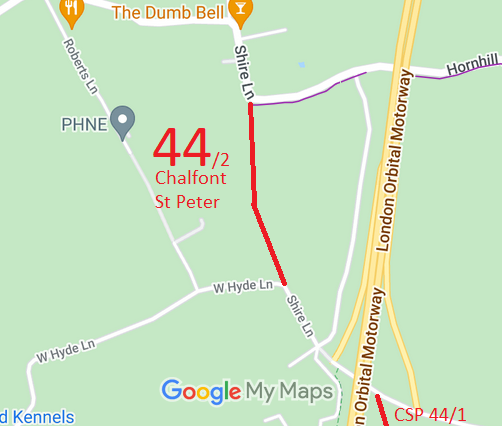 This route runs along the County Boundary between Hertfordshire and Buckinghamshire.
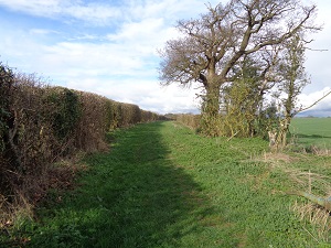 The route of Offley 41 bridleway was shown on the old maps as a public road known as Honeysuckle Lane. An application to upgrade it to restricted byway status was made in 2017. Unfortunately changes were made to part of the route when the A505 was built which caused part of the route to definitely only be a bridleway. In the circumstances there was no point in objecting when the County Council decided not to upgrade the route, but the path did benefit from having its full width recorded and hence protected against encroachment.
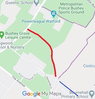 We reported last year that the Hertfordshire County Council (Bushey 76) Modification Order 2019 had been made on the direction of the Secretary of State to record Finch Lane as a byway. There were four objections to the order, and we wait for the County Council to send the order to a new Inspector for determination.
The route is shown in red on the plan. Regular readers will note the proximity of the Homefield Road bridleway that was a success noted in a previous Annual Report.

 The trustees applied to convert the trust to a Charitable Incorporated Organisation on 11 Jun 2020, and the CIO was added to the Register of Charities on 15 Jun 2020 with charity number 1189953 and company number CE022190. HM Revenue & Customs recognised the CIO as charitable under reference ZD08240. This recognition enables the collection of gift aid on qualifying donations to the new organisation. There will be a period of parallel running before the CIO version is the active charity.

The Hertfordshire County Council (St Albans City 104) Modification Order 2019, made 11 Dec 2019 and confirmed 23 Jul 2020, added the turfed-over former slip road to the A405 to the definitive map and statement as a byway open to all traffic.
The Hertfordshire County Council (Offley 41 Bridleway) Modification Order 2019, made 12 Dec 2019 and confirmed 30 Jun 2020, recorded a width for the route and specified in the definitive statement that there were no limitations.
The Hertfordshire County Council (Aldenham 12, Aldenham 84) Modification Order 2018, made 14 Dec 2018, proposes to add a bridleway along the physical roadway though Wall Hall.
The Hertfordshire County Council (Bushey 76) Modification Order 2019, made 27 Nov 2019, proposes to add Finch Lane to the definitive map and statement as a byway open to all traffic.

© 2025 Patchetts Green Bridleways Trust.
