
 The last part of our Aldenham Major Project is the route through Wall Hall itself, on the metalled roadway. In 2012, we applied for this route using user evidence from 1970 onwards. We are pleased that the County Council agreed our application and made an order to record the route as a bridleway. We now have to wait to see if there are objections.
Post-2018 note: There was one objection to the order, and so we wait for the County Council to send it to the Secretary of State for consideration by an Inspector. (We are still waiting as of 5 Sep 2026.)
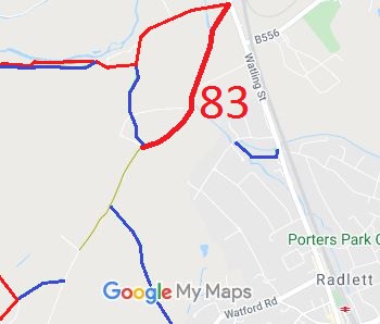 Following all the public inquiries and two trips to the High Court, The Hertfordshire County Council (Aldenham 83 and Aldenham 9) Modification Order 2009 was finally confirmed by an Inspector on 10 October 2018. It was advertised by the County Council on 13 February 2019, and so has come into effect.
The recording of this path was rather interesting, with the High Court giving a judgment that has much wider effect, the discovery that the river was not where the Ordnance Survey good scale maps showed it, and great patience and forbearing from the landowners, who hadn’t challenged any of the rights being considered at all. The recording was necessary, however, because Parliament has decided that unrecorded old routes will be extinguished (with some minor exceptions) in 2026. Our action has saved this route!
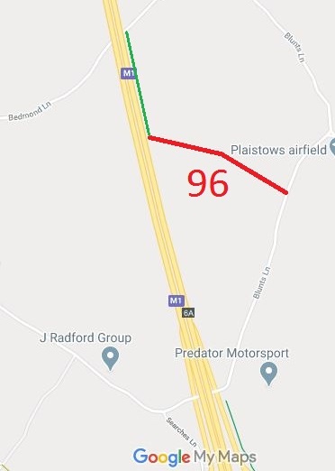 This route was identified as not recorded on the definitive map when members of the Patchetts Green Riding Club surveyed the riding routes in the area as part of the British Horse Socety’s Access and Riding Rights of Way survey in 1991. An application was made in 1997 to record the route and an order to record it was made on 29 Sep 2017.
The order was confirmed on 7 Feb 2018.
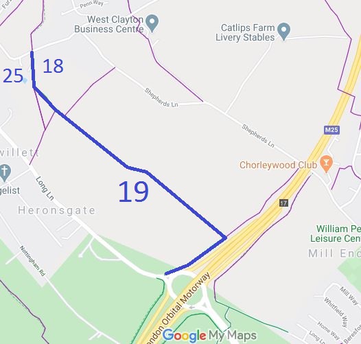 This route runs from Stag Lane (public road) towards M25 motorway, then along the boundary of the M25 to Long Lane (public road), almost opposite Rickmansworth 10 BW. The most northerly piece, Rickmansworth 18, runs along the parish boundary so also is also known as Chorleywood 25 bridleway.
This route was identified as in use and was not recorded on the definitive map. A British Horse Society volunteer collected user evidence to demonstrate that the route was a bridleway. The County Council agreed with the application and an order was made in 2017 and confirmed unopposed in 2018.

The Hertfordshire County Council (St Stephen 96) Modification Order 2017, made 29 Sep 2017 and confirmed 26 Jan 2018, added Featherbed Lane (East of the M1) to the definitive map and statement as a byway for open to all traffic.
The Hertfordshire County Council (Chorleywood 25, Rickmansworth 18 and 19) Modification Order 2017, made 29 Sep 2017 and confirmed 9 Mar 2018, upgraded these footpaths to bridleway on the definitive map and statement.
The Buckinghamshire County Council (Restricted Byway No.44 (Part) Chalfont St Peter and Restricted Byway No.2 Denham) Definitive Map Modification Order 2018, made 14 Aug 2018, proposes to upgrade the Shire Lane route to restricted byway.
The Hertfordshire County Council (Aldenham 12, Aldenham 84) Modification Order 2018, made 14 Dec 2018, proposes to add a bridleway along the physical roadway though Wall Hall.

© 2025 Patchetts Green Bridleways Trust.
