| Patchetts Green Bridleways Trust | ||
| PG: OBJECTS: PROMOTION: Ridge 6 BW and Colney Heath 52 BOAT | ||
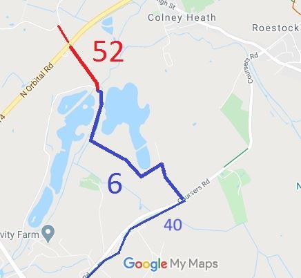
![]() Annotated map reproduced courtesy of Googlemaps. |
The Ridge 6 bridleway starts at Coursers Lane opposite bridleway Ridge 40, has a junction with the bridleway (Ridge 32) that leads to Colney Heath common, and ends at the junction of Colney Heath 52 byway and Ridge 2 bridleway at the parish boundary.
Colney Heath 52 is a byway that leads from Ridge 6 to the A414. Although it is opposite Colney Heath 60 (Woodrake Lane), there is no suitable crossing and cannot be recommended for equestrians. We need a volunteer to photograph this route for this year's Access and Riding Rights of Way Survey. It's easy - just take photographs (safely) when you use the path. Find out more! |
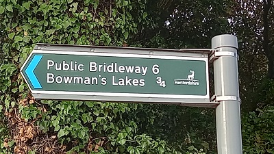
![]() Sign at Coursers Road Photo: Phil Wadey, 22 Sep 2023 |
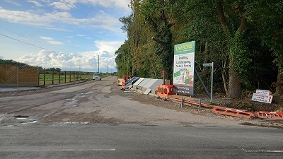
![]() Ridge 6 from Coursers Road Photo: Phil Wadey, 22 Sep 2023 |
|
| Legal History 20 Jun 1953: Colney Heath 52 was recorded as CRB (Carriage Road used as a Bridleway) on the original (1953) definitive map. 20 Jun 1953: Ridge 6 was recorded as a bridleway on the original (1953) definitive map. The Hertfordshire County Council (Bridleway Ridge 6) Diversion Order 1997 altered the alignment of the route. 18 Mar 2025: Lack of council sign at junction of Colney Heath 52 with the North Orbital Road (public road) notified to Hertfordshire County Council. HCC Reference: 401004583177. |
Definitive Statement (4 Dec 2015)
Path: [Ridge] 6. Status: BW. Definitive Map sheets: 68, 77 Commences at junction with county road at S corner of the New Plantation thence NW skirting the SW boundary of plantation to TL 1981 0481, then SW for approx. 220m to TL 1964 0470 then NW for approx. 540m, crossing Footpath 4, to TL 1919 0499. Then follows east side of the hedge N and W to the NE of the pylon at TL 1919 0503 and runs N along the east bank of the River Colne to TL 1926 0542 where it crosses the river to the west, then runs NW for approx. 50m to join Ridge Footpath 1 and Colney Heath BOAT 52 at TL 1923 0546. Width: 3m at TL 1981 0481 and TL 1923 0546. 4m between TL 1981 0481 and TL 1919 0503 and also between TL 1928 0527 and TL 1923 0546. 5-6m between TL 1919 0503 and TL 1928 0527 Limitations:Two Bollards at TL 1981 0481 as specified in the Hertfordshire County Council (Bridleway Ridge 6) Diversion Order 1997. Two bollards at TL 1923 0546 as specified in the Hertfordshire County Council Section 106 Obligation dated 2nd June 2003. Path: [Colney Heath] 52. Status: BOAT. Definitive Map sheet: 68 |
© 2024-2026 Patchetts Green Bridleways Trust.