Legal History
23 Apr 2001: A s.25 Highways Act 1980 Agreement between Hertfordshire County Council and the landowners relating to rights of way at Tyttenhanger came into effect.
14 Jan 2011: The Hertfordshire County Council (Tyttenhanger Bridleway) Creation Order 2011 (confirmed 24 Jun 2011) created the bridleway under the M25 motorway.
15 Sep 2011: The Tyttenhanger Footpath and Bridleways Public Path Creation Agreement 2010 came into effect.
14 Oct 2011: The Hertfordshire County Council (Ridge 40, 42 and Shenley 42, 43, 44) Legal Event Modification Order 2011 recorded the created paths on the definitive map.
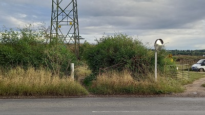
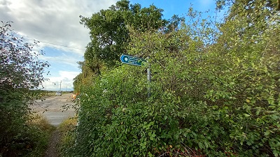
23 Sep 2023: Severe overgrowth at Coursers Road junction reported to Hertfordshire County Council, reference 401003699443.
|
Definitive Statement (4 Dec 2015)
Path: [Ridge] 40. Status: Bridleway.
Definitive Map sheet: 77 and 78
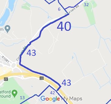
Commences at the parish boundary at a junction with Shenley BR43 at TL 1926 0391
running generally NE for approx 2m then turning generally SE and continuing for approx 15m to TL 1928 0390 then generally NE for approx 15m, crossing the access track, to TL 1929 0392 then generally NW for approx 15m to TL 1928 0392. Then continuing generally NE for approx 40m to TL 1930 0395, then generally NE for approx 185m to TL 1946 0404 and NE for a further 170m to TL 1952 0420. Continuing generally NE for approx 585m to a junction with Coursers Road, opposite Ridge Bridleway 6 at TL 2001 0451.
Width: 6m
Limitations: None
Path: [Shenley] 43. Status: Bridleway.
Definitive Map sheet: 77
Commences at a junction with the B556, Ridge Hill at TL 1984 0302 running generally NE, under the M25, for approx 95m to the northern boundary of the M25 at TL 1990 0309. Continuing generally NE for approx 20m to TL 1991 0310 then generally NW, parallel to the M25, for approx 925m to TL 1910 0351. Continuing generally north for approx 150m to TL 1911 0366 then generally NE, running parallel to Coursers Road, for approx 295m to the parish boundary and a junction with Ridge BR40 at TL 1926 0391.
Width: Varying width of between 5 and 12m, from TL 1984 0302 to TL 1990 0309 as shown shaded grey on the Hertfordshire County Council (Tyttenhanger
Bridleway) Creation Order 2011 Order Plan 6m between TL 1990 0309 and TL 1926 0391.
Limitations: None
|