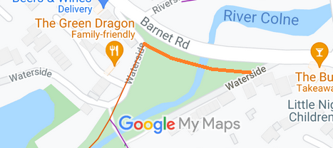
Annotated map reproduced courtesy of Googlemaps.
The route was part of the main road through London Colney prior to the building of the bridge just to the east which now carries Barnet Road. The old route remains in place legally and can still be used. Unfortunately, indiscriminate parking often leaves access difficult for horse drawn carriages, but ridden horses should usually be able to get through.
The photograph (right) is reproduced by permission of the Open Spaces Society from their collection of lantern slides. It shows the route prior to the bridge construction. The date given is only the range 1900-1940.
We need a volunteer to photograph this route for this year's Access and Riding Rights of Way Survey. It's easy - just take photographs (safely) when you use the path. Find out more!
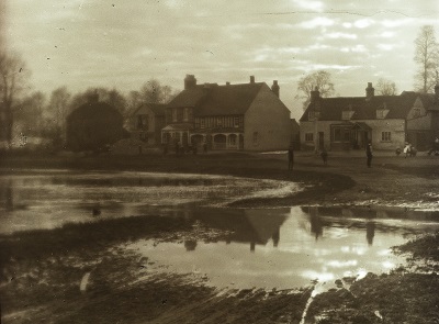
View NW of the Watersplash, early 20th Century
Photo: © Open Spaces Society (CC BY-NC-SA 4.0)