| Patchetts Green Bridleways Trust | ||
| PG: OBJECTS: PROMOTION: Shenley 35 and London Colney 1 RB | ||
| London Orbital Bridleroute: Anti-clockwise: London Colney 2. Clockwise: Bell Lane Pegasus Crossing. | H25 | |
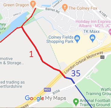
![]() Annotated map reproduced courtesy of Googlemaps. |
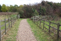
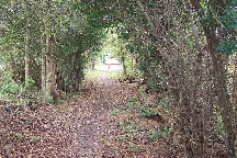
London Colney 1 is a restricted byway running from restricted byway London Colney 2 over the M25 to the parish boundary. It continues as a bridleway, Shenley 35, generally south eastwards to Bell Lane and the Pegasus crossing. |
![]() From parish boundary towards Bell Lane Photo: Phil Wadey, 20 Oct 2005
|
The Shenley 35 route was recorded as a bridleway by our Secretary's first ever modification order application - it had previously been a gap on the definitive map of rights of way. Additional evidence found subsequently has led to a new application to record the Shenley 35 as a restricted byway, the same status as the adjoining London Colney 1 restricted byway.
|
||
| Legal History 20 Jun 1953: London Colney 1 was recorded as CRB (Carriage Road used as a Bridleway) on the original definitive map and statement. DM sheet DM3-31 (TL10SE). 20 Jun 1953: Shenley 35 was not recorded on the original definitive map and statement. DM sheet DM3-31 (TL10SE). 14 Nov 91: The Hertsmere Borough Council (Bridleway No 35 Shenley) Modification Order 1991 (confirmed 29 Jan 1992) added this path to the definitive map and statement as a bridleway. 2 May 2006: Restricted Byway rights were confirmed or created on London Colney 1 by virtue of ss 47 and 48 Countryside and Rights of Way Act 2000. 22 Jul 2020: Application for restricted byway status on Shenley 35 (to remove parish boundary anomaly). |
Definitive Statement (4 Dec 2015)
Path: [Shenley] 35. Status: Bridleway. Definitive Map sheet: 77 Commences at junction with Bell Lane, Shenley (TL 18570 02955) and continues in a north westerly direction for a distance of approx. 88m to the junction with Restricted Byway 1 at the St Albans City and District boundary (TL 18500 03005). Width: varying from 5m at Bell Lane to 3m at the District Boundary. Path: [London Colney] 1. Status: Restricted Byway.
Definitive Map sheet: 77 |
© 2021 Patchetts Green Bridleways Trust. File reference: EC051.
