Legal History
1837: Hexton 13 was shown on the Hexton tithe map as a bridleway owned by the surveyor of highways and as not subject to an apportionment.
1938: The route is not shown on the Hertfordshire County Council ROW survey.
Map Hitchin 6 (IX NW).
1 Nov 1953: The route was not recorded on the original definitive map and statement.
DM sheet DM4-27 (Herts 9 NW).
31 Dec 1977: The route was not recorded on the special review draft map and statement.
DM sheet SR-19 (TL12NW).
10 Jun 2021: The Hertfordshire County Council (Hexton 2 and 13) Modification Order 2021 (confirmed 27 Apr 23) added this route to the definitive map and statement.
|
|
Definitive Statement (4 Dec 2015)
Path: [Hexton] 13. Status: Bridleway.
Definitive Map sheet: 19
Commences from Hexton BR2, south of Mortgrove Plantation, at TL 1066 2933 then runs SSW, across the field, for approx 450m to junction with Hexton BR2 at TL 1056 2890. Continues SSW, across the field, for approx 180m to re-join Hexton BR2 on E side of the field boundary at TL 1047 2874.
Width: 4m.
Limitations: None.
|
Maintainability
This route is maintainable at the public expense because it was a footpath or bridleway existing before 30 Apr 1959.
|
|
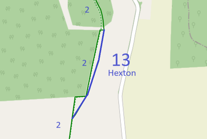

 The Hertfordshire County Council discovered the evidence for thsi route when it was investigating our application to upgarde Hexton 2 footpath to bridleway. See Hexton 2 for more details, including our proposals to simplify the paths in the area to maximise cropping land while providing joined up paths.
