Paths Greenways Bridleways Tracks
 PG: OBJECTS: PROMOTION: Harpenden Nomansland Common
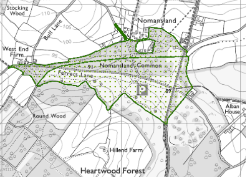
Map showing recorded Hertfordshire paths
Annotated map reproduced courtesy of MAGIC.
This is a common which was in an Urban District prior to 1974. As such it has rights of access on horseback, unless these have otherwise been restricted.

We need a volunteer to photograph routes on the common for the 2021/22 Access and Riding Rights of Way Survey. It's easy - just take photographs (safely) when you use the path. Find out more!

Commons Information

Common Land Number: CL131
Area: 147,505 sq m
Equestrian Rights: s.193 LPA 1925 Former Urban District

Legal History

© 2022 Patchetts Green Bridleways Trust.

Stats2