Paths Greenways Bridleways Tracks
 PG: OBJECTS: PROMOTION: Enfield Whitewebbs Park Southern Route
Whitewebbs Circular Ride: Clockwise: Flash Lane (Enfield 7). Anti-clockwise: Enfield 330.  EW 
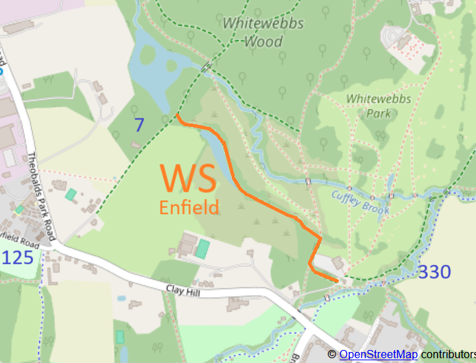
Map showing paths
Map data from © OpenStreetMap and Enfield London Borough Council.
This way starts from Beggars Hollow (public road) almost opposite Whitewebbs Southwest bridleway, and continues generally west, north and westwards to Enfield 7 bridleway (Flash Lane).

A volunteer has photographed this route for the 2025 Access and Riding Rights of Way Survey, and the page will be updated shortly.

At the time of the 2025 Access Survey (6 Jul 25), there were no gates across the path and it was signposted at each end.

Legal History
Path: [Enfield] WS.
[This route is not yet recorded on the definitive map and so there is no definitive statement.]
Location Information
Postcode for SATNAV for anyone inspecting path: EN2 9HQ (for Whitewebbs Park car park).

© 2025 Patchetts Green Bridleways Trust.

Stats2