| Paths Greenways Bridleways Tracks | ||
| PG: OBJECTS: PROMOTION: Chalton (Bedfordshire) 11 FP - Camford Way | ||
| Luton Orbital Bridleroute: Anti-clockwise: Chalton 10 BOAT. Clockwise: Luton 34 BW (western section). | LOB | |
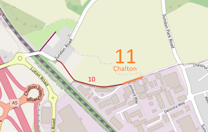
![]() Map data from © OpenStreetMap and Central Bedfordshire Council. |
This route starts from Chalton 10 byway and runs along Camford Way to become Luton 34 at the borough boundary.
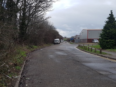
At the time of the BHS 2023 Access Survey (8 Jan 23), there was no path signage on this path. There were no obstructions to use save that vehicles were parked on it at the junction with Chalton 10.
|
![]() View eastwards from western end Photo: Phil Wadey, 8 Jan 2023 |

||
If the Central Bedfordshire Council proposals for an M1 to A6 link road are implemented, this route is upgraded to bridleway.
| ||||
| Legal History 19 Jan 1996: The route is shown as Toddington 86 Byway on the Definitive Map and Statement for the Former Borough of Dunstable, the Borough of Luton and the Former Leighton Buzzard and Linslade Urban and Luton Rural Districts. Map sheet 19. ... |
Definitive Statement
Path: [Chalton] 11. Recorded Status: Footpath. From: C.198 To: Parish Boundary The path is a Footpath. It starts on Byway Open to all Traffic No. 10 at Ordnance Survey Grid Reference TL 0454 2597 and proceeds in an east by northerly direction to connect with Luton Bridleway 34 (formerly Sundon Bridleway 16) at the Parish Boundary. (This path was formerly Toddington FP No 79) |
© 2025 Patchetts Green Bridleways Trust.