Patchetts Green Bridleways Trust
 PG: OBJECTS: PROMOTION: St Stephen 2 BW
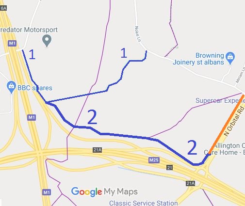
Map showing St Stephen 2 bridleway
Annotated map reproduced courtesy of Googlemaps.
Bridleway 2 St Stephen starts on the North Orbital Road (A405) which is heavily used by motor vehicles. It leads generally westwards towards Bedmond, through a junction with St Stephen 22 and ends at a junction with St Stephen 1 bridleway, which leads back to Noke Lane, through Holt Farm.

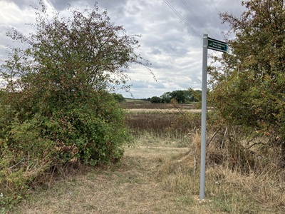
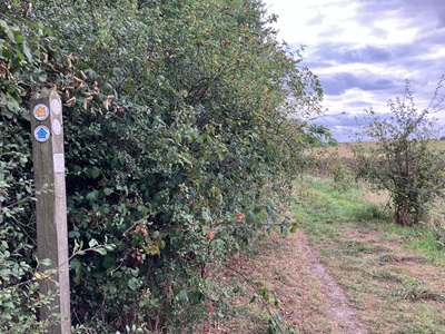
At the time of the 2025 Access Survey (24 Aug 25), there were no gates were across the path. It was waymarked at the junction with St Stephen 1 bridleway and signposted at the junction with the A405. (The finger post was misaligned so this was reported to the County Council.)
Photograph of St Stephen 2 bridleway
View from A405
Photo: Helen Taylor, 28 Aug 2025
Photograph of St Stephen 2 bridleway
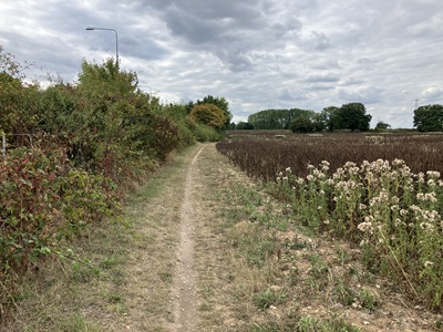
Follow Headland
Photo: Helen Taylor, 28 Aug 2025
Photograph of St Stephen 2 bridleway
Waymark at St Stephen 22 junction
Photo: Helen Taylor, 28 Aug 2025
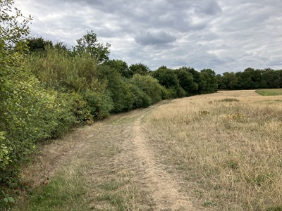
Photograph of St Stephen 2 bridleway
Follow Headland
Photo: Helen Taylor, 28 Aug 2025
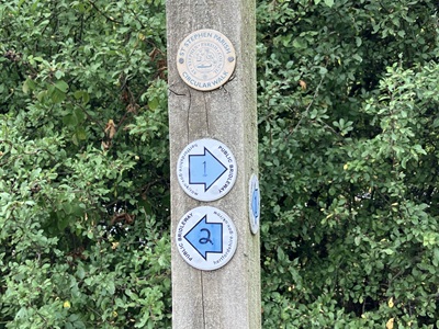
Photograph of St Stephen 2 bridleway
Waymark at St Stephen 1 junction
Photo: Helen Taylor, 28 Aug 2025

BHS PGBT Local equestrian access volunteers, notably John Featherstone of the British Horse Society, have been trying for many years to make the access to this bridleway safer. In 1997, the parish council also asked for the bridleway routing to be improved.

In March 2004, the Hertfordshire County Council consulted the user groups and locals about the extension of Bridleway 2 St Stephen. The scheme would extend the bridleway (shown by the orange route) by creating a new route from that point, running north-eastwards parallel to the A405, to join Noke Lane. The Trust is strongly supporting this scheme. Unfortunately nothing seems to have come of the proposals.

Legal History
20 Jun 1953: St Stephen 2 was recorded as a bridleway on the original definitive map and statement. DM sheet DM3-30.
Altered by the M25 construction work.
The extension of BW 2 to the Lye Lane crossing point is shown on the ROWIP as route 6/190.
25 Aug 2025: Mispointed sign at A405 junction reported to Hertfordshire County Council, reference 401004762103.
Definitive Statement (4 Dec 2015)
Path: [St Stephen] 2.  Status: Bridleway  Definitive Map sheet: 76
Commences at junction with North Orbital Road near the M25 Motorway roundabout at Grid Ref: TL1269 0320 thence generally north-westwards past FP22 and across FP23 to a junction with the connecting road and BR1 at Grid Ref: TL1168 0349.
Maintainability
This route is maintainable at the public expense because it was a footpath or bridleway existing before 30 Apr 1959.

© 2025 Patchetts Green Bridleways Trust.

Stats2