Paths Greenways Bridleways Tracks
 PG: OBJECTS: PROMOTION: Streatley (Bedfordshire) 41 RB
Icknield Way (Hertfordshire East section): To the Ridgeway: Streatley 23. To the Peddars Way: Hexton 8 and Lilley 23 byway.  IWRR 
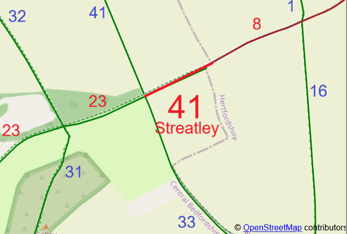
Map showing recorded paths
Map data from © OpenStreetMap, Hertfordshire County Council and Central Bedfordshire Council.
This way starts from the junction with Streatley 23 restricted byway and Streatley 33 bridleway, and continues generally north-eastwards to a junction with Hexton 8 byway at the county boundary.

We need a volunteer to photograph this route for the Access and Riding Rights of Way Survey. It’s easy - just take photographs (safely) when you use the path. Find out more!

Legal History
23 Jan 2026: The Central Bedfordshire Council (Definitive Map and Statement for Central Bedfordshire) (Streatley Restricted Byway No 23) Modification Order 2026, made 23 Jan 2026 and confirmed 8 May 2026, upgraded the county boundary bridleway (including part of Streatley 41) to restricted byway.
Definitive Statement (20 Jan 2026)
Path: [Streatley] 41.  Recorded Status: Restricted Byway.
Now subsumed into Streatly 23.
Maintainability
This route is maintainable at the public expense because it was a highway before 1835.

© 2026 Patchetts Green Bridleways Trust.

Stats2