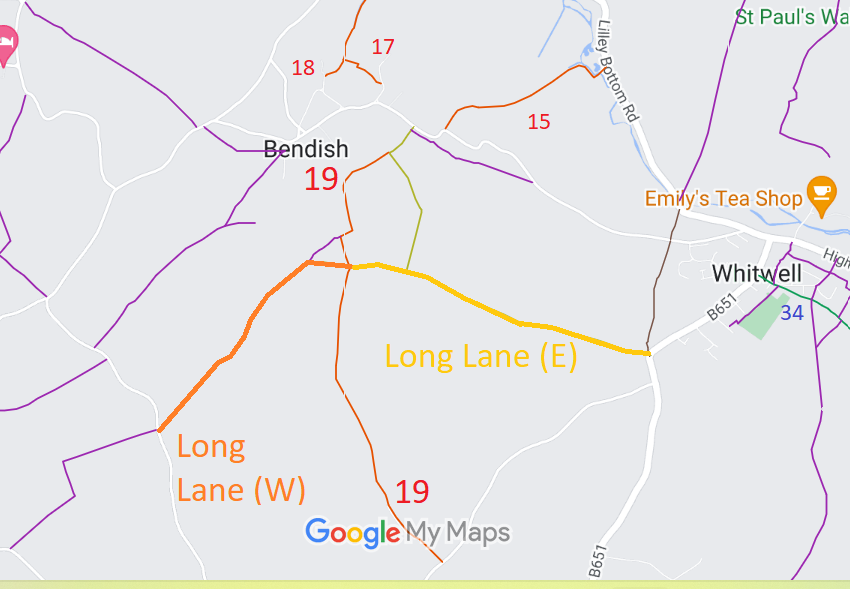
Annotated map reproduced courtesy of Googlemaps.
We need a volunteer to photograph this route for this year's Access and Riding Rights of Way Survey. It's easy - just take photographs (safely) when you use the path. Find out more!
| Paths Greenways Bridleways Tracks | ||
| PG: OBJECTS: PROMOTION: St Paul's Walden Long Lane | ||
Annotated map reproduced courtesy of Googlemaps. |
This route starts from Whitewaybottom Lane (public road) and heads generally northeastwards to a junction with St Paul's Walden 21 then generally east to St Paul's Walden 19 restricted byway, then generally southeastwards to a junction of the B651 public road and St Paul's Walden 36 byway.
We need a volunteer to photograph this route for this year's Access and Riding Rights of Way Survey. It's easy - just take photographs (safely) when you use the path. Find out more! |
| Legal History 12 Feb 2010: Application EC355 for Long Lane (East) to be recorded as a byway. HCC reference NH/210. 12 Feb 2010: Application EC356 for Long Lane (West) to be recorded as a byway. HCC reference NH/210. 9 Nov 2017: Landowner Deposit under s.31(6) Highways Act 1980 admits Long Lane as an unclassified county road. | [This route is not yet recorded and so there is no definitive statement.] |
© 2022 Patchetts Green Bridleways Trust.
File reference: EC355, EC356. HCC reference: NH/210.
