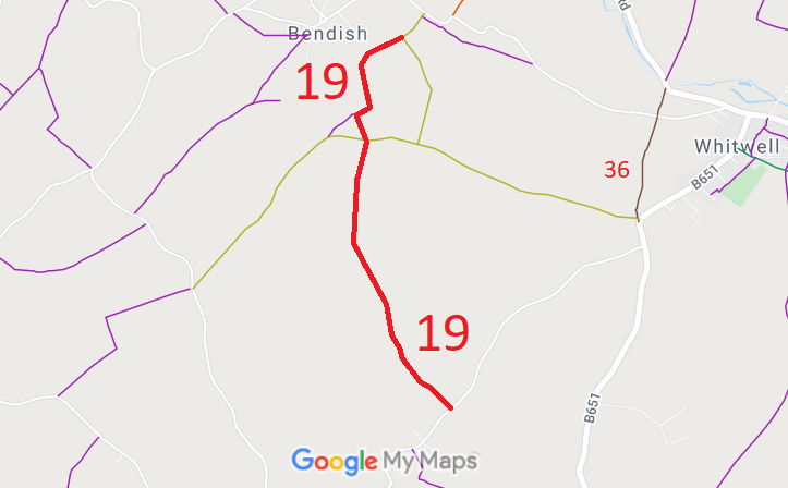
Annotated map reproduced courtesy of Googlemaps.
We need a volunteer to photograph this route for this year's Access and Riding Rights of Way Survey. It's easy - just take photographs (safely) when you use the path. Find out more!
| Paths Greenways Bridleways Tracks | ||
| PG: OBJECTS: PROMOTION: St Paul's Walden 19 RB | ||
Annotated map reproduced courtesy of Googlemaps. |
This route starts from an unclassified public road and heads southwest then generally south to cross Long Lane then continues generally south and southeastwards to meet the public road.
We need a volunteer to photograph this route for this year's Access and Riding Rights of Way Survey. It's easy - just take photographs (safely) when you use the path. Find out more! |
| Legal History 1938: The route is shown as St Paul's Walden 19 BW (blue dots) on the Hertfordshire County Council ROW survey. Maps Hitchin Rural West 14 (Herts 29 NE) and 17 (Herts 29 SE). 9 Nov 2017: Landowner Deposit under s.31(6) Highways Act 1980 admits the part of St Pauls Walden 19 within the relevant ownership boundary as a restricted byway. |
Definitive Statement (4 Dec 2015)
Path: [St Paul's Walden] 19. Status: Restricted Byway. Definitive Map sheets: 28 and 42 Commences from county road E of Pickerings Farm thence SW and generally S across county road skirting NE corner of Heyshams Spring and SW corner of small spinney thence SE to join county road NE of the Holt. |
© 2024 Patchetts Green Bridleways Trust.
