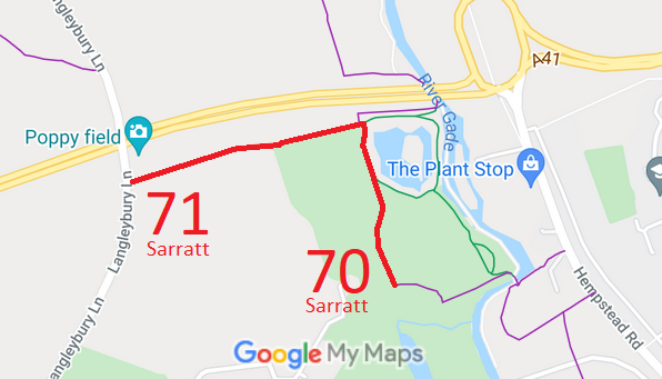
Annotated map reproduced courtesy of Googlemaps.
We need a volunteer to photograph these routes for this year's Access and Riding Rights of Way Survey. It's easy - just take photographs (safely) when you use the path. Find out more!
| Paths Greenways Bridleways Tracks | ||
| PG: OBJECTS: PROMOTION: Sarratt 70 and 71 | ||
Annotated map reproduced courtesy of Googlemaps. |
We need a volunteer to photograph these routes for this year's Access and Riding Rights of Way Survey. It's easy - just take photographs (safely) when you use the path. Find out more! |
| Legal History 20 Jun 1953: Abbots Langley 41 and 39 were recorded as CRFs (Carriage Roads used as a Footpath) on the original definitive statement. DM sheet DM3-36. 24 Jan 1973: The 'spare' part of the western end of Abbots Langley 71 was stopped up when the adjoining road was moved eastwards by The London North Orbital Trunk Road (Hunton Bridge to Maple Cross Section Side Roads) Order 1973. 31 Dec 1977: Abbots Langley 39 and 41 were shown as footpaths on the special review draft map and statement. There were objections so the paths were left as Roads Used as Public Paths (RUPPs). DM sheet SR-83. When the parish boundary moved, the paths were renumbered. Abbots Langley 41 became Sarratt 70. Abbots Langley 39 became Sarratt 71. 2 May 2006: Restricted Byway rights were confirmed or created on these paths by virtue of ss 47 and 48 Countryside and Rights of Way Act 2000. |
Definitive Statement (4 Dec 2015)
Path: [Sarratt] 70. Status: Restricted Byway. Definitive Map sheet: 83 Commences at junction with FP74 S of A405 at Clarendon Park Farm thence S continuing to The Grove. Path: [Sarratt] 71. Status: Restricted Byway.
Definitive Map sheet: 83 |
© 2022 Patchetts Green Bridleways Trust.
