| Paths Greenways Bridleways Tracks | ||
| PG: OBJECTS: PROMOTION: Sandon 34 and part of 33 FP | ||
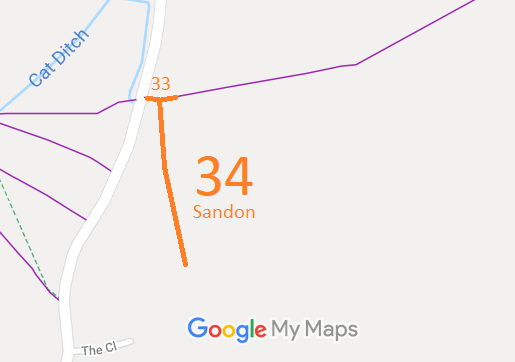
![]() Annotated map reproduced courtesy of Googlemaps. |
This route runs the main road through Redhill, on the western side of Sandon parish, for a short distance to a disused church and burial ground.
We need a volunteer to photograph this route for this year's Access and Riding Rights of Way Survey. It's easy - just take photographs (safely) when you use the path. Find out more! |

|||
As part of the British Horse Society's work to record paths before
Path Extinguishment Day,
it was spotted that Sandon 34 and part of Sandon 33 were recorded as a footpath, although the historical documents show that they are old roads. In order not to lose the rights on 1 January 2026, an application was made to record the route as a restricted byway.
| ||||
| Legal History 3 Oct 2020: Application to record Sandon 34 and part of Sandon 33 as a restricted byway. HCC reference NH/333. |
Definitive Statement (4 Dec 2015)
Path: [Sandon] 34. Status: Footpath. Definitive Map sheet: 14 Commences from FP33 immediately E of county road thence S to Congregational Chapel, Redhill. Path: [Sandon] 33. Status: Footpath.
Definitive Map sheet: 14 |
© 2022 Patchetts Green Bridleways Trust. File reference: EC784.