Legal History
1 Nov 1953: Reed 20 was recorded as a footpath on the original definitive map and statement. DM sheet DM4-23 (Herts 9 NW). The extension eastwards was not recorded.
31 Dec 1977: Reed 20 was shown as a footpath on the special review draft map and statement. DM sheets SR-8 and SR-15.
17 Apr 2023: Application for restricted byway status. HCC reference NH/345.
|
Definitive Statement (4 Dec 2015)
Path: [Reed] 20. Recorded Status: Bridleway/Footpath.
Definitive Map sheets: 8, 15
Commences as a BR from junction of county road and BR10, SW of Fiddlers Green thence S to junction of FP17 & BR9. Change to a FP thence S to join FP14 (Buckland) E of Reed Wood on parish boundary.
Path: [Reed] 23. Status: Bridleway.
Definitive Map sheets: 8, 15
Commences from Restricted Byway 23 Barkway Parish, thence south along west side of field
boundary into Buckland Parish.
|
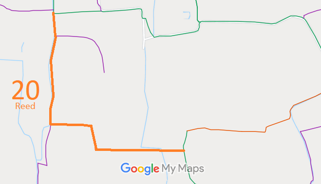
 As part of the British Horse Society's work to record paths before
Path Extinguishment Day,
it was spotted that the old maps showed a route joining Reed 20 to Reed 23. The historical evidence showed a continuous route, so an application was made in 2023 to record it as restricted byway.
