Paths Greenways Bridleways Tracks
 PG: OBJECTS: PROMOTION: Northchurch EC775
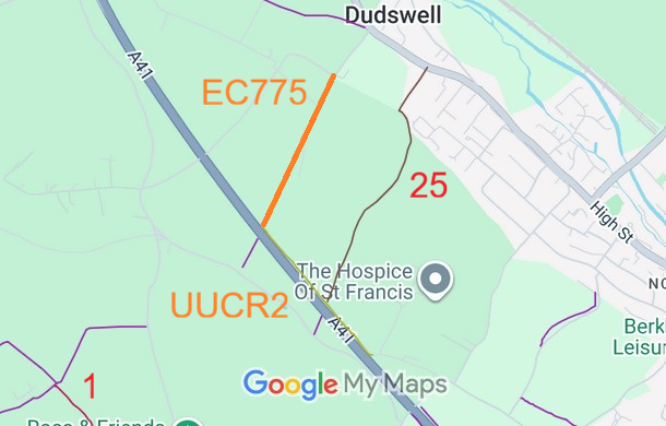
Map showing recorded Hertfordshire paths
Annotated map reproduced courtesy of Googlemaps.
This route runs from Hamberlins Road (public road) generally southwestwards to Northchurch UUCR2.

We need a volunteer to photograph this route for the Access and Riding Rights of Way Survey. It’s easy - just take photographs (safely) when you use the path. Find out more!

BHS PGBT As part of the Trust’s and the British Horse Society’s work to record paths before Path Extinguishment Day, it was spotted that this route was unrecorded. The historical evidence showed a continuous route, so an application was made in 2025 to record the gap.

Legal History
1766: Shown as a road on Dury and Andrews Map of Hertfordshire.
1822: Shown as ‘Lanes and Bridleways’ on Bryant’s map of Hertfordshire.
1910: Shown untaxed (a ‘white road’) on the Inland Revenue Valuation Plan.
20 Jun 1953: The route was not recorded on the original definitive map and statement, but is marked 'unclassified county road'. DM sheet DM3-19 (Herts 33 NE; SP90NE).
31 Dec 1977: The route was not shown on the special review draft map and statement. DM sheet SR-64.
1980: Shown as county road 2U53 on the Hertfordshire County Council Land Charges Map.
Path: [Northchurch].  Recorded Status: None.  Definitive Map sheet: 64
[This route is not yet recorded on the definitive map and so there is no definitive statement.]
Maintainability
This route is maintainable at the public expense because it was a highway before 1835.

© 2026 Patchetts Green Bridleways Trust. File reference: EC775. HCC reference: DAC/132.

Stats2