Legal History
1 Nov 1953: This route was not recorded on the original definitive map. DM sheet DM4-20.
31 Dec 1977: This route was not recorded on the special review draft map and statement. DM sheet SR-7.
2 May 2006: NERC exemption s.67(2)(b) as part of route not on DM but was on LOS.
28 Jun 2010: Application to record the old road as a byway. HCC reference NH/217.
31 Jan 2019: Hertfordshire County Council directed to determine the application by the Secretary of State. (FPS/M1900/14D/17)
17 Feb 2022: The Hertfordshire County Council (Kelshall 18, 19, 21 and 22) Modification Order 2022 (confirmed 18 Dec 2024) added the route to the definitive map and statement as part restricted byway and part byway open to all traffic.
|
| Application Process |
| Path |
Application |
Certificate |
Direction |
Inv Report |
Order |
Confirmed |
| EC561 |
28 Jun 2010 NH/217 |
16 Nov 2010 |
31 Jan 2019 (12m) |
8 Dec 2020 |
17 Feb 2022 |
18 Dec 2024 |
| Inquiry Timetable - ROW/3320533 |
| Path |
Start Date |
OMA SOC |
Other SOCs |
POEs |
Inquiry |
Result |
| EC561 |
5 Jun 2024 |
31 Jul 2024 |
11 Sep 2024 |
8 Oct 2024 |
5 & 28 Nov 2024 |
18 Dec 2024 |
|
Definitive Statement (1 Jan 2022)
Path: [Kelshall] 21. Status: BOAT/RB.
Definitive Map sheet: 7
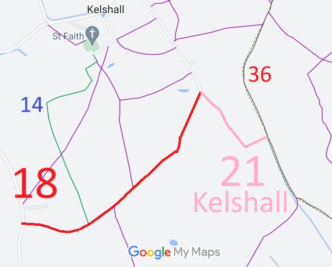
Whites Lane commences as a BOAT from The Street (public highway) at TL 3334 3601 then SE along the track for approx 320m to right-angled bend at TL 3355 3577. Continues as an RB ENE along the track for approx 110m to join Therfield BOAT 36 at the parish boundary at TL 3364 3581.
Width: Varies between 7m and 13m between TL 3334 3601 and TL 3364 3581 as shaded grey in the Hertfordshire County Council (Kelshall 18, 19, 21 and 22) Modification Order 2022.
Limitations: None.
|
Maintainability
This route is maintainable at the public expense because it was a highway before 1835.
|
|
 As part of the British Horse Society's work to record paths before
Path Extinguishment Day,
it was spotted that this route was unrecorded. The historical evidence showed a continuous route for hundreds of years, so an application was made in 2010 to record the route.
The County Council agreed with the application and an order was made in 2022 and confirmed (after public inquiry) in 2024.
This is a good example of 'perfectly obvious paths' that would be extinguished by the Countryside and Rights of Way Act 2000 if an application had not been made in time.
