Paths Greenways Bridleways Tracks
 PG: OBJECTS: PROMOTION: Pirton 20 RB and Hitchin Town 3 RB - Oughton Head Lane
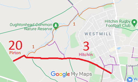
Map showing Pirton 20 restricted byway
Annotated map reproduced courtesy of Googlemaps.
This route starts on Hitchin Road as Pirton 20 and continues generally northeastwards to a junction with Hitchin 1 restricted byway. It continues generally eastwards, through junctions with Hitchin 4 bridleway and Hitchin 5 bridleway before turning southeastwards and ending on Oughton Head Way (public road).

We need a volunteer to photograph this route for this year's Access and Riding Rights of Way Survey. It's easy - just take photographs (safely) when you use the path. Find out more!
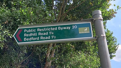
Sign at Western end

Sign at junction with Hitchin Road
Photo: Phil Wadey, 28 Jul 2024
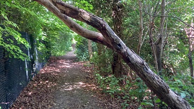
View along Pirton 20, close to western end

View from Hitchin Road
Photo: Phil Wadey, 28 Jul 2024

Legal History
1938: The route in Pirton is shown as Pirton BW 12 on the Hertfordshire County Council ROW survey. The route in Hitchin Town was in an excluded area. Map Hitchin Rural West 7 (Herts 11 NE).
1 Nov 1953: The route was recorded as CRB (Carriage Road used as a Bridleway) on the original definitive statement. DM sheets DM4-28 and DM4-31.
31 Dec 1977: The route was shown as a bridleway on the special review draft map and statement, but this was objected to. It therefore remained a RUPP. DM sheet SR-20.
2 May 2006: Restricted Byway rights were confirmed or created on this path by virtue of ss 47 and 48 Countryside and Rights of Way Act 2000.
9 Aug 2024: Tree across path (near western end) reported to HCC, reference 401004260947.
Definitive Statement (4 Dec 2015)
Path: [Pirton] 20.  Status: Restricted Byway.  Definitive Map sheet: 20
Commences from Pirton - Hitchin Road by pumping station thence NE along parish boundary to join Restricted Byway 3 (Hitchin Town) at Oughton Head.

Path: [Hitchin] 3.  Status: Restricted Byway.  Definitive Map sheet: 20
Commences from junction of Oughtonhead Way and Victoria Road as Restricted Byway to junction with BOAT 7 thence NW as Restricted Byway along Oughtonhead Lane past BR5 thence W past FP2 and BR4 to parish boundary at Oughton Head.
Width: 8-10ft

Maintainability
This route is maintainable at the public expense by virtue of s.49(1) Countryside and Rights of Way Act 2000. [RB converted from RUPP]

© 2024 Patchetts Green Bridleways Trust.