
| PG: OBJECTS: PROMOTION: Hexton Common Lane |
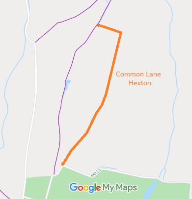 Annotated map reproduced courtesy of Googlemaps. |
This route runs from Mill Lane generally northwards then west to meet Hexton 6 footpath.
We need a volunteer to photograph this route for this year's Access and Riding Rights of Way Survey. It's easy - just take photographs (safely) when you use the path. Find out more! |
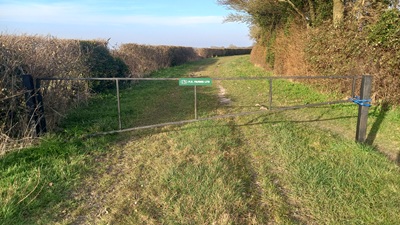
View from Mill Lane |
||
 As part of the British Horse Society's work to record paths before
Path Extinguishment Day,
it was spotted that Common Lane Hexton was neither recorded on the definitive map nor shown in the County Council's List of Streets. The historical evidence showed that most of the route carries vehicular and equestrian rights, and so an application was made in 2018 to record the route. Subsequently, it turned out that the East Herts Footpaths Society had already applied for the route and that the County Council had decided that an order should be made. No reason has been found for the lack of an order which appears to be an oversight. | ||||
|
| |||||||||||||||||||||||||||||
© 2024 Patchetts Green Bridleways Trust.
File reference: EC062.
HCC reference: NH/43.
