Paths Greenways Bridleways Tracks
 PG: OBJECTS: PROMOTION: Hertford Heath 4
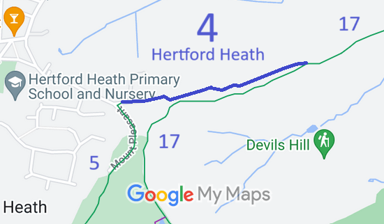
Map showing recorded Hertford Heath paths
Annotated map reproduced courtesy of Googlemaps.
This bridleway starts from Mount Pleasant (public road) and Hertford Heath 5 bridleway and continues generally eastwards to a junction with Hertford Heath 17 bridleway.

We need a volunteer to photograph this route for this year's Access and Riding Rights of Way Survey. It's easy - just take photographs (safely) when you use the path. Find out more!
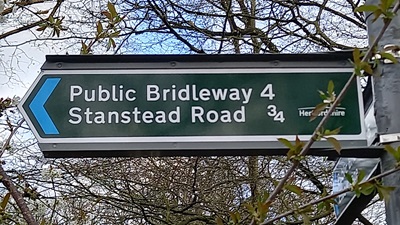
Photograph of Hertford Heath 4
Sign at Western End
Photo: Phil Wadey, 28 Mar 2024
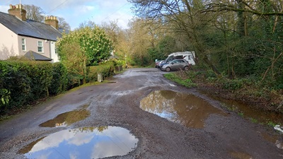
Photograph of Hertford Heath 4
View from Western End
Photo: Phil Wadey, 28 Mar 2024

Legal History
2 Feb 1953: Hertford Heath 4 was recorded as Little Amwell 4 bridleway on the original definitive map and statement. DM sheet DM2-23 (Herts 29 SE).
31 Dec 1977: Hertford Heath 4 was shown as Little Amwell 4 bridleway and Great Amwell 38 bridleway on the special review draft map and statement. DM sheet SR-60 (TL31SE).
1 Apr 1990: The parish of Hertford Heath was created out of Little Amwell and parts of neighbouring parishes, resulting in some path number changes.
Definitive Statement (4 Dec 2015)
Path: [Hertford Heath] 4.  Status: Bridleway.  Definitive Map sheet: 60
Commences at junction with county road at New Zealand Cottages, Little Amwell thence E and NE parallel to BR17 through Goldings Wood to junction with BR17 opposite Much Wood. (former Little Amwell BR4 and Great Amwell BR38).
  Location Information
Postcode for SATNAV for anyone inspecting path: SG13 7RB (western end of path).

© 2024 Patchetts Green Bridleways Trust.

Stats2