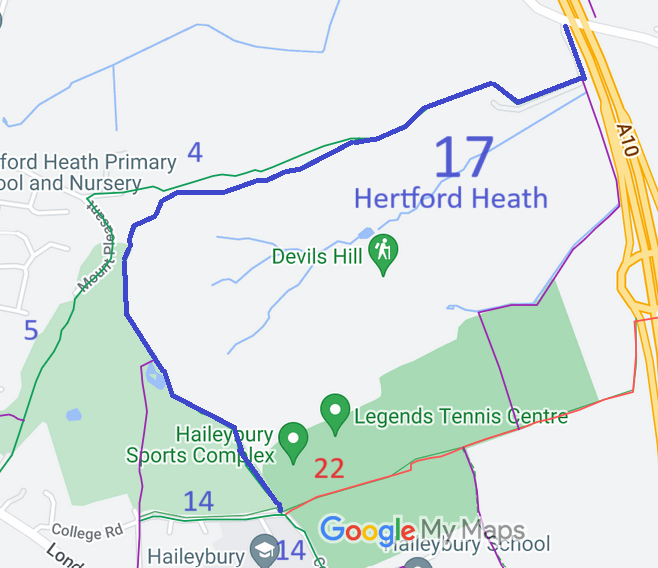
Annotated map reproduced courtesy of Googlemaps.
We need a volunteer to photograph this route for this year's Access and Riding Rights of Way Survey. It's easy - just take photographs (safely) when you use the path. Find out more!
| Paths Greenways Bridleways Tracks | ||
| PG: OBJECTS: PROMOTION: Hertford Heath 17 | ||
Annotated map reproduced courtesy of Googlemaps. |
This route starts from the junction of Hertford Heath 14 bridleway and Hertford Heath 22 restricted byway and continues generally northwards then eastwards to a junction with Hertford Heath 4 bridleway then eastwards and northwards to end on Stanstead Lane (public road).
We need a volunteer to photograph this route for this year's Access and Riding Rights of Way Survey. It's easy - just take photographs (safely) when you use the path. Find out more! |
|
| |||||||||
© 2024 Patchetts Green Bridleways Trust.
File reference: EC1236.
