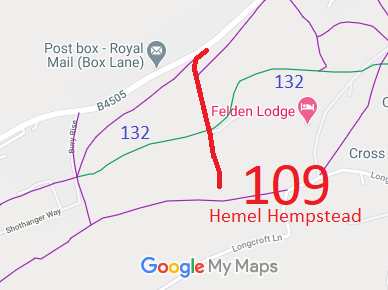
Legal History
20 Jun 1953: The route was recorded as CRB (Carriage Road used as a Bridleway) on the original definitive statement. DM sheet DM3-20 and DM3-.
31 Dec 1977: The route was shown as a bridleway on the special review draft map and statement. DM sheets SR-65 and SR-74.
2 May 2006: Restricted Byway rights were confirmed or created on this path by virtue of ss 47 and 48 Countryside and Rights of Way Act 2000.
|
Definitive Statement (4 Dec 2015)
Path: [Hemel Hempstead] 109. Status: Restricted Byway
Definitive Map sheets: 65 and 74
Starts in Box Lane as a BR near junction with FP110 as metalled road to junction with
BR132. Continues as a FP to exit at borough boundary by five-barred field gate.
|