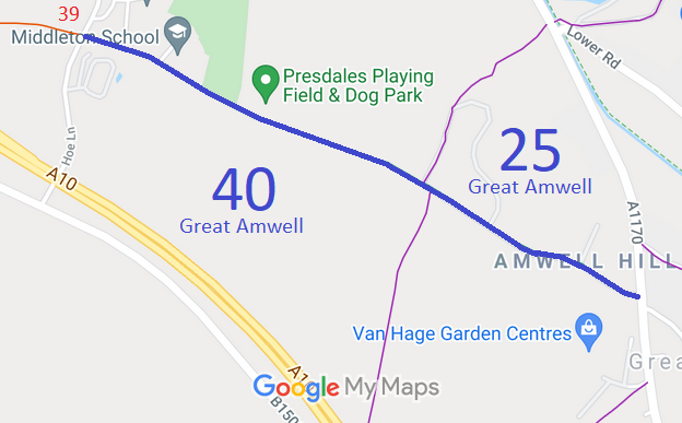
Annotated map reproduced courtesy of Googlemaps.
We need a volunteer to photograph this route for this year's Access and Riding Rights of Way Survey. It's easy - just take photographs (safely) when you use the path. Find out more!
| Paths Greenways Bridleways Tracks | ||
| PG: OBJECTS: PROMOTION: Great Amwell 25 and 40 | ||
Annotated map reproduced courtesy of Googlemaps. |
This bridleway starts in Hoe Lane opposite Great Amwell 39 restricted byway (Thieves Lane). It runs generally southeastwards, changing number at the former parish boundary, to end on the A1170, opposite a lane which leads to Great Amwell 18.
We need a volunteer to photograph this route for this year's Access and Riding Rights of Way Survey. It's easy - just take photographs (safely) when you use the path. Find out more! |
|
| |||||||||
© 2024 Patchetts Green Bridleways Trust.
File reference: EC1192.
