Paths Greenways Bridleways Tracks
 PG: OBJECTS: PROMOTION: Great Amwell 16 FP
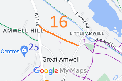
Map showing recorded Great Amwell paths
Annotated map reproduced courtesy of Googlemaps.
This route runs from Amwell Hill (public road) to Cautherly Lane (public road). It is not yet physically available for use by riders. (Please let us know if this changes.)

At the time of the 2024 Access Survey (17 Nov 24), there were obstructions at each end of the route, but each could be ridden around. It was signposted at each end (at the current recorded status of footpath).
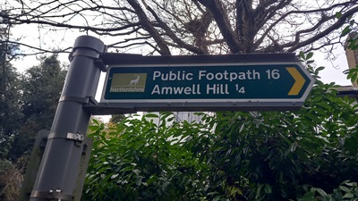
Photograph of Great Amwell 16 heading NW
Sign at SE end, Cautherly Lane
Photo: Phil Wadey, 17 Nov 2024
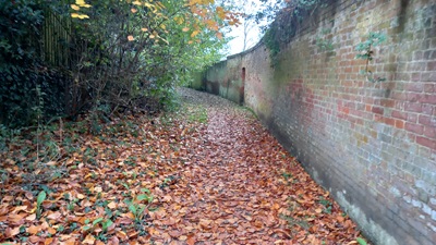
Photograph of Great Amwell 16 heading NW
Continuing Northwestwards
Photo: Phil Wadey, 17 Nov 2024
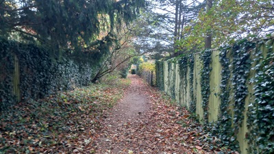
Photograph of Great Amwell 16 heading NW
Continuing Northwestwards
Photo: Phil Wadey, 17 Nov 2024
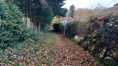
Photograph of Great Amwell 16 heading NW
Continuing Northwestwards
Photo: Phil Wadey, 17 Nov 2024
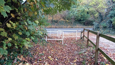
Photograph of Great Amwell 16 heading NW
Continuing Northwestwards
Photo: Phil Wadey, 17 Nov 2024
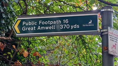
Photograph of Great Amwell 16 heading NW
Sign at NW end, Amwell Hill
Photo: Phil Wadey, 17 Nov 2024

BHS PGBT 12 Stars As part of the Patchetts Green Bridleways Trust's and the British Horse Society's work to record paths before Path Extinguishment Day, it was spotted that this route appeared to be an old road. The historical evidence from the tithe commutation and the Inland Revenue valuation showed a continuous route, so an application was made in 2024 to record the route as a restricted byway.

Legal History
1839: Great Amwell 16 is shown on the Great Amwell tithe map as not subject to an apportionment.
2 Feb 1953: The route was recorded as a footpath on the original definitive map and statement. DM sheet DM2-26 (Herts 30 SW).
31 Dec 1977: The route was shown as a footpath on the special review draft map and statement. DM sheet SR-60 (TL31SE).
20 Oct 2024: Application for RB. HCC reference EH/551.
Application Process
Path Application Certificate Direction Inv Report Order Confirmed
EC1237 20 Oct 2024 EH/551 17 Nov 2024        
Definitive Statement (4 Dec 2015)
Path: [Great Amwell] 16.  Recorded Status: Footpath.  Definitive Map sheet: 60
Commences at county road S of The Grove thence NW to join Ware - Hoddesdon Road N of Ravenscourt.
Maintainability
This route is maintainable at the public expense because it was a footpath or bridleway existing before 30 Apr 1959.
Location Information
Postcode for SATNAV for anyone inspecting path: SG12 9RU (for Mageways Close, short walk to middle of path).

© 2024 Patchetts Green Bridleways Trust. File reference: EC1237. DOBBIN reference: HER-0175. HCC reference: EH/551.

Stats2