Definitive Statement (4 Dec 2015)
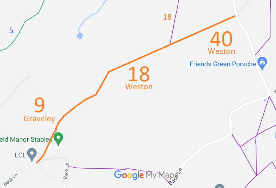
Path: [Graveley] 9. Recorded Status: Footpath.
Definitive Map sheet: 21
Commences from county road at SE corner of The Grove thence NE along western side of
Harbourclose Wood to join parish boundary E of Stonesley Wood.
Path: [Weston] 18. Recorded Status: Footpath.
Definitive Map sheet: 22
Commences from Weston - Stevenage Road approx. 1/4 mile SW of entrance to The Park at
S end of Damask Green, thence W past Paddock thence S SW to join FP40 thence SW to
join FP9 (Graveley) at parish boundary E of Stonesley Wood.
Path: [Weston] 40. Recorded Status: Footpath.
Definitive Map sheet: 22
Commences from Weston - Stevenage Road opposite southern entrance to The Park thence
SW to join FP18.
 As part of the British Horse Society's work to record paths before
Path Extinguishment Day,
it was spotted that this route was in regular ridden use, and so an application to record it as bridleway was made based on user evidence.
