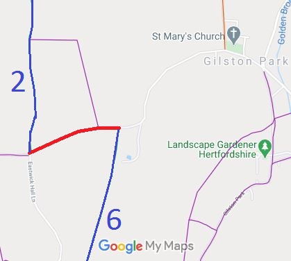
Annotated map reproduced courtesy of Googlemaps.
It is not recorded as a public right of way. Google maps show that there was a county council 'permissive restricted byway' sign at the western end in June 2012.
| Paths Greenways Bridleways Tracks | ||
| PG: OBJECTS: PROMOTION: EAST HERTS: Eastwick and Gilston Garman's Lane | ||
Annotated map reproduced courtesy of Googlemaps. |
This route runs from Eastwick Hall Lane eastwards to Eastwick and Gilston 6 BW and Church Lane, Gilston.
It is not recorded as a public right of way. Google maps show that there was a county council 'permissive restricted byway' sign at the western end in June 2012. |
| Legal History | Definitive Map sheet: 61 |
© 2022 Patchetts Green Bridleways Trust.
File reference: EC440.
