Legal History
2 Feb 1953: Cheshunt 26 and Cheshunt 65 were recorded as footpaths on the original definitive map and statement. DM sheet DM2.
26 Jul 2017: Application for restricted byway. HCC reference BRX/59.
|
Definitive Statement (4 Dec 2015)
Path: [Cheshunt] 65. Recorded Status: Footpath.
Definitive Map sheet: 80
This footpath enters from Bread and Cheese Lane without any obstruction. After about 100
yards the cinder track ends at same Nursery gates on the south side and the path continues
straight on as a grass track for a further 200 yards. At this point it joins a cinder track leading
from Tanfield Farm to Hammond Street. After a further 200 yards it joins FP26 which
crosses it at right angles.
Path: [Cheshunt] 26. Recorded Status: Footpath.
Definitive Map sheet: 71, 80
Footpath commences east side of Five Ash Nursery down gravel lane for 150 yards in
northerly direction then when lanes turn east FP continued straight on down grassy lane
between high hedges until stile is reached in hedge. (rest of description omitted)
|
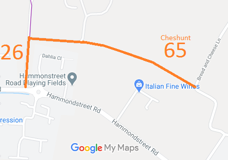
 As
part of the British Horse Society's work to record paths before
Path Extinguishment Day,
it was spotted that this route was unrecorded. An application has been made to record it as a restricted byway based on historical evidence.
