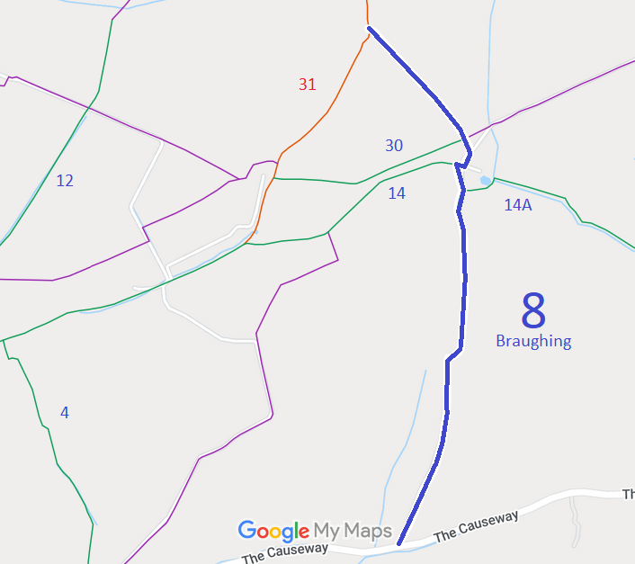
Annotated map reproduced courtesy of Googlemaps.
We need a volunteer to photograph this route for this year's Access and Riding Rights of Way Survey. It's easy - just take photographs (safely) when you use the path. Find out more!
| Paths Greenways Bridleways Tracks | ||
| PG: OBJECTS: PROMOTION: Braughing 8 | ||
Annotated map reproduced courtesy of Googlemaps. |
This route starts from The Causeway (public road) and continues generally northwards through junctions with
Braughing 14A bridleway,
Braughing 14 bridleway, and
Braughing 10 bridleway,
to end on
Braughing 31 restricted byway.
We need a volunteer to photograph this route for this year's Access and Riding Rights of Way Survey. It's easy - just take photographs (safely) when you use the path. Find out more! |
| Legal History 11 May 1979: The Hertfordshire County Council Bridleways 8 and 14 (Parish of Braughing) Public Paths Diversion Order 1979, confirmed 29 Aug 1980, diverted these paths. HCC reference DM1/068. 19 Sep 1980: London Gazette announcement of confirmation of the order on 29 Aug 1980. |
Definitive Statement (4 Dec 2015)
Path: [Braughing] 8. Status: Bridleway. Definitive Map sheet: 25 Commences at county road SW of parish boundary, thence N to junction with BR14a (at TL 4162 2725) thence N to junction with BR14 (at TL 4160 2732) near Rotten Row, thence NW to junction with Restricted Byway 31 by Spinney. |
© 2024 Patchetts Green Bridleways Trust.
