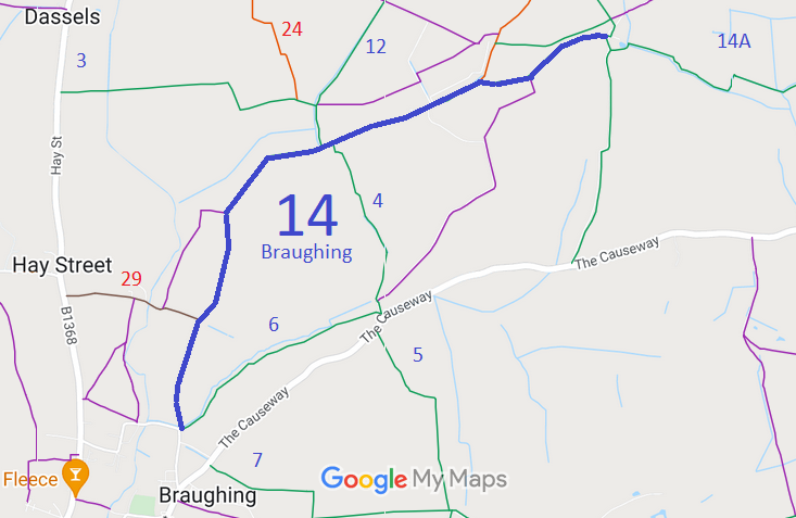
Annotated map reproduced courtesy of Googlemaps.
We need a volunteer to photograph this route for this year's Access and Riding Rights of Way Survey. It's easy - just take photographs (safely) when you use the path. Find out more!
| Paths Greenways Bridleways Tracks | ||
| PG: OBJECTS: PROMOTION: Braughing 14 | ||
Annotated map reproduced courtesy of Googlemaps. |
This page is still being prepared.
We need a volunteer to photograph this route for this year's Access and Riding Rights of Way Survey. It's easy - just take photographs (safely) when you use the path. Find out more! |
| Legal History 11 May 1979: The Hertfordshire County Council Bridleways 8 and 14 (Parish of Braughing) Public Paths Diversion Order 1979, confirmed 29 Aug 1980, diverted these paths. HCC reference DM1/068. 19 Sep 1980: London Gazette announcement of confirmation of the order on 29 Aug 1980. |
Definitive Statement (4 Dec 2015)
Path: [Braughing] 14. Status: Bridleway. Definitive Map sheet: 24 and 25 Commences at junction with county road SW end of Braughing Bourne thence N past Pentlow Hill thence N past junction with FP2b thence generally NE past junction with BR12 and 4 thence NE past junction with Restricted Byway 31 at Bozen Green thence NE to junction with BR8 near Rotten Row (at TL 4160 2732). |
© 2024 Patchetts Green Bridleways Trust.
