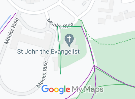
Annotated map reproduced courtesy of Googlemaps.
We need a volunteer to photograph this route for this year's Access and Riding Rights of Way Survey. It's easy - just take photographs (safely) when you use the path. Find out more!.
| Paths Greenways Bridleways Tracks | ||
| PG: OBJECTS: PROMOTION: Welwyn Garden City 29 | ||
Annotated map reproduced courtesy of Googlemaps. |
This page is still being prepared.
We need a volunteer to photograph this route for this year's Access and Riding Rights of Way Survey. It's easy - just take photographs (safely) when you use the path. Find out more!. |
| Legal History HCC file reference DM2/040 may be relavant to this path. 31 Dec 1977: The route was shown as a bridleway on the special review draft map and statement. DM sheet SR-57. |
Definitive Statement (4 Dec 2015)
Path: [Welwyn Garden City] 29. Status: Bridleway. Definitive Map sheet: 57 Commences at SW of St John's Church to junction with FP21 at NE corner of Church. |
|
Location Information
Postcode for SATNAV for anyone inspecting path: AL8 7NX. |
© 2024 Patchetts Green Bridleways Trust.