Paths Greenways Bridleways Tracks
 PG: OBJECTS: PROMOTION: Watford Rural 6
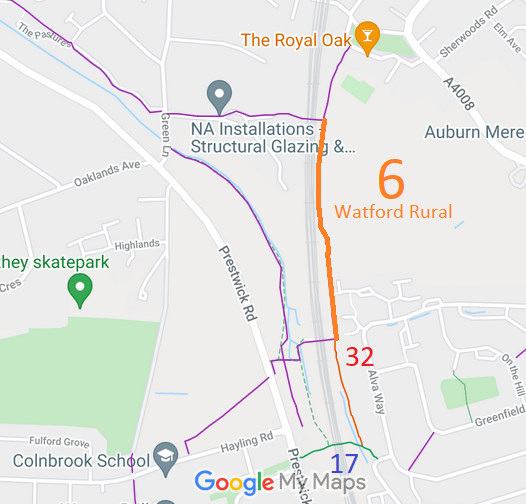
Map showing recorded Watford Rural paths
Annotated map reproduced courtesy of Googlemaps.
This section of Watford Rural 6 appears to be in use by cyclists and some riders. It runs from Watford Rural 32 restricted byway generally northwards to a junction with Watford Rural 5.

At the time of the BHS 2021 Access Survey (16 Oct 21), the route was open and unobstructed. There was signage at the junctions with the paths at either end of the ridden section.
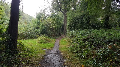
Photograph of Watford Rural 32 and 6
1. Path seen from Watford Rural 32
Photo: Phil Wadey, 16 Oct 2021
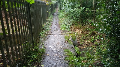
Photograph of Watford Rural 6
2. Heading northwards
Photo: Phil Wadey, 16 Oct 2021
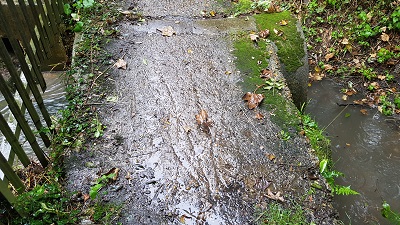
Photograph of Watford Rural 6
3. Culvert over stream
Photo: Phil Wadey, 16 Oct 2021
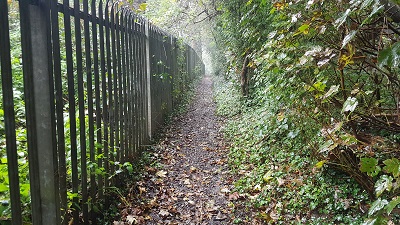
Photograph of Watford Rural 6
4. Heading northwards
Photo: Phil Wadey, 16 Oct 2021
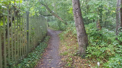
Photograph of Watford Rural 6
5. Heading northwards
Photo: Phil Wadey, 16 Oct 2021
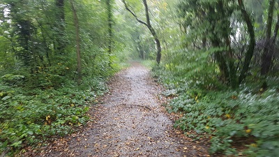
Photograph of Watford Rural 6
6. Heading northwards
Photo: Phil Wadey, 16 Oct 2021
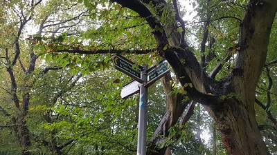
Photograph of Watford Rural 6
7. Sign at junction with Watford Rural 5
Photo: Phil Wadey, 16 Oct 2021

Legal History
9 Nov 2007: The Hertfordshire County Council (Watford Rural 32) Modification Order 2007 altered the statement for Watford Rural 6 to record its junction with Watford Rural 32.
Definitive Statement (4 Dec 2015)
Path: [Watford Rural] 6.  Status: Footpath.  Definitive Map sheet: 90
Commences at southern end of tarmac path from Watford Heath (Borough of Watford) thence S on E side of Railway, past Railway Bridge leading to FP5 thence S along Railway fence crossing Culvert thence S to a junction with RB32 at TQ 1177 9385 thence continues to 'Cattle Bridge' under Railway thence W through Bridge to TQ 1170 9384 thence SW across stream to TQ 1169 9383 thence S along edge of stream for approx 35m to TQ 1170 9380 thence W for approx 45m to junction with FP7 and FP8 at TQ 1165 9380, thence W for approx 30m to junction with A4542 Prestwick Road at TQ 1162 9380 thence SE for approx 20m to TQ 1163 9378 and SW to its junction with Hayling Road on the LCC Estate, Oxhey.
Width: Minimum 2m between TQ 1170 9384 and TQ 1163 9378.
Maintainability
This route is maintainable at the public expense because it was a footpath or bridleway existing before 30 Apr 1959.

© 2025 Patchetts Green Bridleways Trust. File reference: EC471.

Stats2