Paths Greenways Bridleways Tracks
 PG: OBJECTS: PROMOTION: Wareside 26
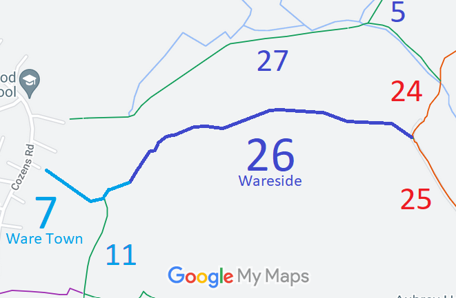
Map showing recorded Wareside and Ware Town paths
Annotated map reproduced courtesy of Googlemaps.
Wareside 26 runs from Ware Town 7 bridleway generally northeastwards, eastwards then southeastwards to the junction with Wareside 24 and Wareside 25 restricted byways.

We need a volunteer to photograph this route for this year's Access and Riding Rights of Way Survey. It's easy - just take photographs (safely) when you use the path. Find out more!

BHS As part of the British Horse Society's work to record paths before Path Extinguishment Day, it was spotted that the historical evidence showed this route carried restricted byway rights and so an application was made in 2018 to amend the definitive map and statement.

Legal History
2 Feb 1953: The route was recorded as bridleway on the original definitive statement. DM sheet DM2-24 (Herts 30 NW) and DM2-26 (Herts 30 SW).
31 Dec 1977: The route was shown as a bridleway on the special review draft map and statement. DM sheet SR-60 (TL31SE).
12 Feb 2018: Application to record as restricted byway. HCC reference EH/463.
Definitive Statement (4 Dec 2015)
Path: [Wareside] 26.  Status: Bridleway.  Definitive Map sheet: 60
Commences from junction with Restricted Byway's 24 and 25 at Swades Farm thence W along southern edge of Jackson's Grove thence generally S to join BR7 (Ware Town) near parish boundary thence S along same to BR11 (Ware Town) and to Much Hadham Road.

© 2022 Patchetts Green Bridleways Trust. File reference: EC1015. HCC reference: EH/463.

Stats2