Paths Greenways Bridleways Tracks
 PG: OBJECTS: PROMOTION: Walkern 8A
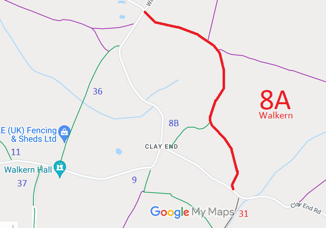
Map showing recorded Walkern paths
Annotated map reproduced courtesy of Googlemaps.
This route runs from the cross roads at Bassus Green, through a junction with Walkern 8B to end on the public road, close to the junction with Walkern 31 Byway.

The route was recorded as Walkern 8A CRB on the original definitive map, but was removed at the special review on the grounds that it was a public road that didn't need to be shown on the definitive map and statement.

Legal History
2 Feb 1953: The route was recorded as CRB (Carriage Road used as a Bridleway) on the original definitive statement. DM sheet DM2-02 (Herts 13 SW).
31 Dec 1977: The route was not shown (but was labelled 'county road') on the special review draft map and statement. DM sheets SR-23 and SR-31.
Former Definitive Statement (2 Feb 1953)
Path: [Walkern] 8A.  Status: CRB.  Definitive Map sheet: DM2-02 (1953), 23 and 31 (2015)
Commences at Bassus Green and follows county road E, S, and SE to join county road SE of Clay End.

© 2022 Patchetts Green Bridleways Trust.

Stats2