Legal History
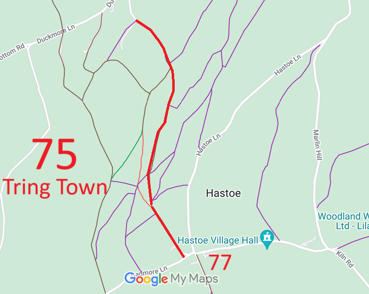
20 Jun 1953: Tring Town 75 was recorded as CRB (Carriage Road used as a Bridleway) on the original definitive map and statement.
DM sheets DM3-10 (Herts 25SW, SP91SW) and DM3-18 (Herts 32NW, SP90NW).
31 Dec 1977: Tring Town 75 was shown as a byway open to all traffic on the special review draft map and statement.
DM sheets SR-51 (SP91SW) and SR-63 (SP90NW).
2 May 2006: NERC exemption s.67(1) as route shown on DM as Byway Open to All Traffic.
|
|
Definitive Statement (4 Dec 2015)
Path: [Tring Town] 75. Status: Byway Open to All Traffic.
Definitive Map sheets: 51 and 63
Commences from FP32a at Upper West Leith Farm thence SE and S through Deacons Hill
Wood to Hastoe House and Hastoe Road.
Statement should reference junction with West Leith (public road 2U268) at FP32a end.
|
Maintainability
This route is maintainable at the public expense by virtue of para 7 of Sch 3 to the Countryside Act 1968. [Converted from RUPP]
|
|