Legal History
20 Jun 1953: Tring Town 36 was recorded as CRB (Carriage Road used as a Bridleway) on the original definitive map and statement. DM sheet DM3-10 and DM3-18 (Herts 25 SW and 32 NW; SP90NW & SP91SW)
31 Dec 1977: Tring Town 36 was shown as a byway open to all traffic on the special review draft map and statement.
DM sheet SR-51 and SR-63 (SP91SW & SP90NW).
2 May 2006: NERC exemption s.67(1) as route shown on DM as Byway Open to All Traffic.
|
|
Definitive Statement (4 Dec 2015)
Path: [Tring Town] 36. Status: Byway Open to All Traffic.
Definitive Map sheets: 61 and 63
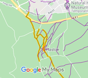
Commences from Akeman Street (Roman Road) at Drayton Manor Lodge. Thence generally
south west over By-pass, then south-east along By-pass boundary to Fox Lane, following Fox Lane and county boundary to cross Dancers End Road, thence through Dog Wood and Pavis Wood to end at South East corner of same to junction with Hastoe Road.
|
Maintainability
This route is maintainable at the public expense by virtue of para 7 of Sch 3 to the Countryside Act 1968. [Converted from RUPP]
|
|