Paths Greenways Bridleways Tracks
 PG: OBJECTS: PROMOTION: Streatley (Bedfordshire) 22
Luton Orbital Bridleroute: Anti-clockwise: Streatley 23 RB. Clockwise: Streatley 24.  LOB 
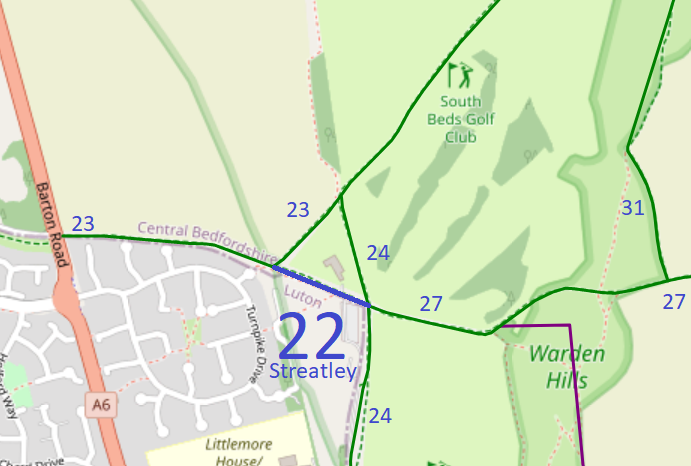
Map showing recorded paths
Map data from © OpenStreetMap and Central Bedfordshire Council.
This path starts from Streatley 23 restricted byway (Luton Orbital Bridleroute) and continues southwestwards to end at a junction with Streatley 24 (Luton Orbital Bridleroute) and Streatley 27 bridleways.

A volunteer has photographed this route for the 2026 Access and Riding Rights of Way Survey, and the page will be updated shortly. Find out more!

At the time of the 2026 Access Survey (30 Aug 26), no gates were across the path and it was waymarked at each end.

Legal History
19 Jan 1996: The route is shown as Streatley 22 bridleway on the Definitive Map and Statement for the Former Borough of Dunstable, the Borough of Luton and the Former Leighton Buzzard and Linslade Urban and Luton Rural Districts. Map sheet 20.
Definitive Statement
Path: [Streatley] 9.  Recorded Status: Bridleway.
[Definitive statement is to follow.]
Maintainability
This route is maintainable at the public expense because it was a footpath or bridleway existing before 30 Apr 1959.

© 2023-2026 Patchetts Green Bridleways Trust.

Stats2