Patchetts Green Bridleways Trust
 PG: OBJECTS: PROMOTION: South Mimms [formerly Potters Bar] 50 BW
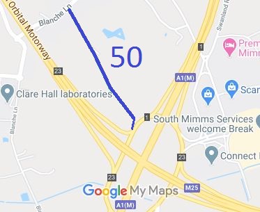
Map showing South Mimms 50 bridleway
Annotated map reproduced courtesy of Googlemaps.
The route is shown in blue on the plan, and runs from Blanche Lane along a well defined track (which is also an access to some houses and a cattery) through a small industrial site then across the field to a bridlegate. It passes through the gate, down the ramp to the A1 at Bignell's Corner. Take extreme care if using this route.

We need a volunteer to photograph this route for this year's Access and Riding Rights of Way Survey. It's easy - just take photographs (safely) when you use the path. Find out more!

At the time of the 2006 Access Survey (28 Dec 06), there was a sign at each end, but the route through the industrial estate was difficult. There were hazards on the ground, and the used route had been rerouted away from the definitive route, to the side.
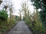
Photograph of South Mimms 50 bridleway
Track, after passing the houses
Photo: Phil Wadey, 28 Dec 2006
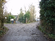
Photograph of South Mimms 50 bridleway
Go to the right as the track splits
Photo: Phil Wadey, 28 Dec 2006
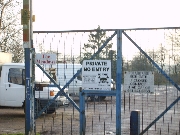
Photograph of South Mimms 50 bridleway
Industrial area. Gap to left of gate for horses.
Photo: Phil Wadey, 28 Dec 2006
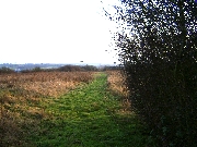
Photograph of South Mimms 50 bridleway
View across field towards A1, after leaving industrial area
Photo: Phil Wadey, 28 Dec 2006
Reserved for photo of route on slope to A1

Legal History
1 Aug 1953: This path was recorded as bridleway 50 in the Urban District of Potters Bar on the initial definitive map for the County of Middlesex.
1 Apr 1965: The path transferred to Hertfordshire under local government reorganisation.
This path is in South Mimms Parish from May 2008, when the South Mimms Parish was created by SI 2008/43. The path number remains the same.
20 Apr 2025: Planning Application 24/1185/OUT proposes to build houses on the former industrial area, including a soft-surface bridleway to the east side of that area. There will be increased traffic on the access route. PGBT comments submitted to the planners. Our ref. ED263.
Definitive Statement (10 Dec 2005)
Path: [South Mimms] 50.  Status: Bridleway
Starts on the south east side of Blanche Lane east of No. 41 and proceeds south east over a cart road then south east across field to rails by a field gate in south east corner, continuing to A1(M)/M25 South Mimms roundabout.
Maintainability
This route is maintainable at the public expense because it was a footpath or bridleway existing before 30 Apr 1959.

© 2025 Patchetts Green Bridleways Trust. File reference: ED263.

Stats2