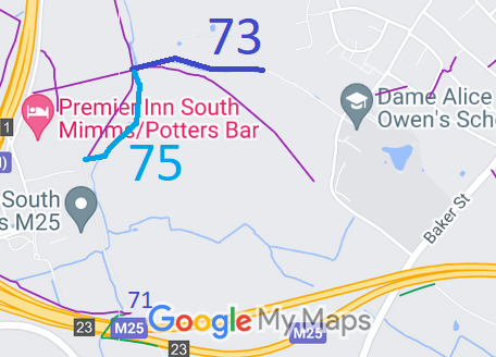
Annotated map reproduced courtesy of Googlemaps.
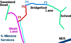
Sketch plan of route
Potters Bar 73 is shown in blue on the sketch, and runs from the metalled part of Bridgefoot Lane to, and including, the bridge over the river.
Potters Bar 75 is a bridleway that leaves Bridgefoot Lane on the east side of the bridge, runs in the river for a while before exiting west on a track leading to Wash Lane.
We need a volunteer to photograph this route for this year's Access and Riding Rights of Way Survey. It's easy - just take photographs (safely) when you use the path. Find out more!
 The Potters Bar 75 route was not recorded on the definitive map, and following our instigation, the two landowners
affected, namely the Wrotham Park Settled Estate, and the Marquis of
Salisbury, executed deeds of dedication so that the recording could
happen by the speeded up (that is, uncontested) means. The route is
shown in red on the sketch.
